George Firman
Firman, George (L)
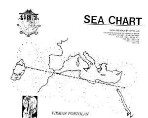
George Firman published a 1978 speculative map of Atlantis[913], on which he located it in the Atlantic. Firman’s ‘portolan’ is allegedly based on “ancient charts drawn during the Ice Age circa 15,100 BP.”) He included Mediterranean details based on Angelino Dulcert’s 14th century charts.
In 1985 Firman published Atlantis, A Definitive Study[914], a 125-page offering with 45 maps, photos and diagrams. The author touches on Phoenicians, dolphins(!), Edgar Cayce and of course ancient maps.

