Latest News

Joining The Dots
I have now published my new book, Joining The Dots, which offers a fresh look at the Atlantis mystery. I have addressed the critical questions of when, where and who, using Plato’s own words, tempered with some critical thinking and a modicum of common sense.Read More »
Philippe Buache
Buache, Philippe
Philippe Buache (1700-1773) was a French royal geographer who produced a map of Antarctica,  apparently ice free, showing the landmass being composed of two separate islands. Understandably, this map was seized upon by fans of Charles Hapgood, who had suggested the existence of a highly developed ancient civilization, with advanced cartographic skills(c)(d).
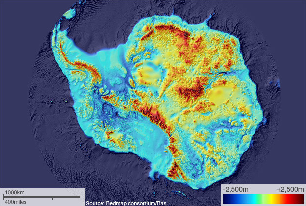
In 1958 a seismic survey of Antarctica seemed to confirm that configuration. This begged a number of questions. How could Buache have known this, without having earlier maps available to him? How could man have drawn maps of territory covered by ice for hundreds of thousands of years? Some felt that this complemented the evidence for an ice-free Antarctica provided by the Piri Reis Map. In turn, this gave some further support to those that advocate an Antarctic location for Atlantis. However, the two maps contradict each other, which should not be the case if they were based on surveys carried out by an advanced prehistoric civilisation.
However, the weight of the present ice cap has depressed the land to such an extent that if removed, it has been calculated that the isostatic rebound would be as much as 500 metres, which would give us a single landmass. This casts doubt on the possibility that a two-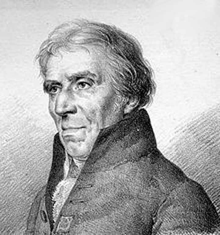 island, ice-free Antarctica ever existed and consequently that the Buache Map is only speculative.
This is reinforced by the fact that “the French legends that cover the Buache Map also provide a clue as to the way the map may be read and understood. For example, the words conjecturée (conjectured) and soupçonnée (suspected) can be found on parts of the southern continent, indicating that this landmass was not copied from some ancient map, but was a hypothesis by Buache.”(b)
Another critical review of the Buache Antarctic map is to be found on the bad archaeology website(a).