Latest News

Joining The Dots
I have now published my new book, Joining The Dots, which offers a fresh look at the Atlantis mystery. I have addressed the critical questions of when, where and who, using Plato’s own words, tempered with some critical thinking and a modicum of common sense.Read More »
James R. Smith
Geodesy
Geodesy is usually defined as the measurement and mapping of the Earth. James R. Smith, the author of Introduction to Geodesy [1947] has conflated several definitions to produce “Geodesy, from the Greek, literally means dividing the earth, and as a first objective, the practice of geodesy should provide an accurate framework for the control of national topographical surveys. Thus, geodesy is the science that determines the figure of the Earth and the interrelation of selected points on its surface by either direct or indirect techniques. These characteristics further make it a branch of applied mathematics, one that must include observations that can be used to determine the size and shape of the earth and the definition of coordinate systems for three dimensional positioning; the variation of phenomena near to, or on the surface, such as gravity, tides, earth rotation, crustal movement, and deflection of the plumb line; together with units of measurement and methods of representing the curved earth surface on a flat sheet of paper.”
Geodesy as a science can be traced back to Pythagoras (6th cent. BC), who was thought to be the first to propose the sphericity of the Earth. Aristotle & Archimedes were apparently the first to offer a figure for the diameter of the Earth, suggesting 400,000 and 300,000 stades, respectively. The difference might be partly explained by the use of a different length of stade.
Later, Eratosthenes (276 BC– 195 BC) offered another early attempt to determine the dimensions of our Earth and succeeded with remarkable accuracy.
A controversial aspect of modern geodesy is the claim that many ancient sites were deliberately established at locations that had a specific geodetic relationship to each other and/or the dimensions of the Earth. For example(a) in ancient Egypt, the distance from Giza to the Equator was calculated to be 1/12th the circumference of the Earth, Amarna to the Equator is 1/13th, Luxor 1/14th and Philae 1/15th!
Graham Hancock in his Heaven’s Mirror[855] pointed to similar relationships around the globe, suggesting a possible world grid. This idea of a world grid has a number of supporters, but is often classified as a ‘fringe’ interest, due to the attempt by some to link gridlines with UFOs and their use of the grid as a power source(w). Hancock’s various claims regarding the dimensions of the pyramids and their association with a suggested world grid has been challenged in great detail by a Hall of Maat article by Thomas W. Schroeder(ah). He concluded that “Graham Hancock’s assertion that the Great Pyramid’s dimensions reveal knowledge of earth’s dimensions certainly lacks proof but also fails to hold up to any scrutiny as a viable theory. Each step argued by Hancock; that the Great Pyramid was built to a specific scalar, that the value of the scalar can be definitively demonstrated, that the scalar indicates precession, that the only way ancient Egyptians could estimate precession is to leverage or borrow knowledge from earlier advanced and unrecognized civilizations, are each filled with flaws when taken individually, let alone when strung together to complete his narrative.”
The idea of a global grid has been pursued by a number of investigators, often with conflicting results. In the 1980s, William Becker and Bethe Hagens, published their widely referenced Planetary Earth Grid(aj). They “discussed the code of the Platonic Solids’ positions on Earth, ascribing this discovery to the work of Ivan P. Sanderson, who was the first to make a case for the structure of the icosahedron at work in the Earth. He did this by locating what he referred to as Vile Vortices refer to a claim that there are twelve geometrically distributed geographic areas that are alleged to have the same mysterious qualities popularly associated with the Bermuda Triangle, the Devil’s Sea near Japan, and the South Atlantic Anomaly.”(ak)
Possible related features may be the ley lines identified by Alfred Watkins in Britain(c)(g), the Alesia alignments in France discovered by Xavier Guichard(b) and/or the Heilige Linien of Germany, claimed by Wilhelm Teudt(aa) and supported by Henrich Himmler.
Xavier Guichard (1870-1947) is described as a Paris police chief and philologist. Between 1911 and 1936, he carried out an extensive study of French place-names and found that there were at least 400 sites with names derived from Alesia. When mapped, these hundreds of sites all lay on lines radiating from today’s town of Alaise, reminiscent of Alfred Watkins leylines! Francis Hitching, in The World Atlas of Mysteries [307.78] tells of how Guichard self-published his book, only to have his home bombed during the war in 1945, killing him and destroying most copies of his book. Elsewhere(b) the year of his death is given as 1947! Hitching included two maps reconstructing Guichard’s work.
Ashley Cowie has published a paper(ac) related to Alesia and the work of Guichard and others, as well as his own investigations.
Heinz Kaminski claimed to have discovered a megalithic grid system that stretched from Stonehenge across Europe with an east-west and north-south orientation and referred to as the Stonehenge/Wormbach System(h).
Even more exotic is the ancient Raetiastone navigation system rediscovered by Gerhard Pirchl (1942-2013) and outlined in a book by [1831] Thomas Walli(ae).
I should point out that Marcel Mestdagh also identified a form of a road system, laid out in giant ovals with radials in France. At the centre of these ovals was the ancient city of Sens. Philip Coppens informs us [1275.184] that a further strange discovery by Mestdagh, was that this ancient road network, centred on Sens, was mirrored by a similar network of roads in England, centred on Nottingham!
‘The Way of Virachoca’ in the Andes, which runs through Tiwanaku and is oriented exactly 45° west of true north and runs for over 1000 miles, it has been studied by Maria Scholten d’Ebneth [1236] in the 1970s and expanded on by a number of Spanish speaking commentators and is now the subject of an article by Dave Truman(x).
In 1973, three Russians, engineers Valery Makarov and Vyacheslav Morozov, along with Nikolay Goncharov, an artist, published an article in Russian with the eye-catching title of, Is the Earth a Giant Crystal? (y) This was probably the earliest presentation of an earth grid based on ancient historical sites. A brief history of the Earth grid theories that emerged around this time is available online(z). There is now a Russian geodesy website with an English translation(ab).
David Hatcher Childress published his Anti-Gravity and the World Grid [1303] in 1993, with the modest claim that he “proves that the earth is surrounded by an intricate electronic grid network offering free energy.” Obviously, Childress’ understanding of ‘proof’ is different to mine, as the only proof required is the production of some of this free energy, which he has not done.
Tom Brooks(ai) entered the fray with a study of 1500 prehistoric sites and his conclusion that the inhabitants of ancient Britain had designed a navigation system based on a grid of isosceles triangles(i). Brooks has gone a step further and speculatively claimed that the accuracy of this geometry-based system could only have been designed through “extraterrestrial intervention”(r). This concept is explored more fully in his latest book, Seeing Around Corners: Geometry in Stone Age Britain [863] and in a series of video clips(s). A more critical view of Brooks’ ideas is also available on the Internet(j).
Some years ago, a former employee of a NASA sub-contractor, Maurice Chatelain, claimed that within a 450-mile radius of the Aegean island of Delos, 13 mystical sites, when connected by straight lines formed a perfect Maltese Cross(u)!
Others such as Livio Stecchini(d) and Jim Alison(e) using geodetic calculations, have identified São Tomé and Cape Verde, respectively as the location of Atlantis. I must also include Hugo Kennes, a Belgian researcher with a passionate interest in global grids and sacred geometry(l). Kennes has also informed me of a new Facebook group(q) which deals with all aspects of the subject, as well as another(v) that includes submerged cities and other features.
Anyone interested in pursuing a study of this subject might like to look over James Q. Jacobs’ archaeogeodesy website(f) as well as the BioGeometry website (m).
If you have pursued all the links so far, you can pamper yourself further with a paper(k) by William Becker and Beth Hagens(n). Another researcher in this field is Dan Shaw, whose website(o) gives a good overview of the subject.
Jean-Pierre Lacroix added his weight to the debate with his 1998 paper entitled, The Mapmakers from the Ice Age(t).
A global network of sacred sites was also put forward by Rand Flem-Ath & Colin Wilson in, The Atlantis Blueprint [063]. This book was intended as a sequel to, When the Sky Fell [062], but it generally wandered off into other areas after the first couple of chapters.
I am somewhat sceptical about certain aspects of geodesy, particularly some of the claims of a world grid. However, it does raise many questions that require further study and explanation. In this connection, I would recommend John Sase’s, Curious Alignments [1589] as a good starting point. He confirms the work of Guichard and also offers a range of his own discoveries in the Great Lakes region.
In February 2020, Frank Maglione Nicholson, Ken Phungrasamee & David Grimason, collectively known as The Nazca Group(ad), published, The Nazca Great Circle Map Hypothesis. Their claim is that “The lines and geoglyphs carved into the Nazca plateau represent a map of the Earth. The map is a Great Circle Map: a gnomonic projection, with the center of the Earth as its cartographic viewpoint. Each line on the Nazca Plateau represents a great circle of navigation centred at the centre of the Earth and encircling the entire planet. The majority of the lines on the Nazca Plateau radiate from five loci of origin called radial centres.” I found this rather esoteric proposition difficult to absorb.
Arturo Villamarin has published many books [1864] and papers(af)(ag) in which the geometry and astronomy of archaeological monuments; Göbekli Tepe, Stonehenge, Teotihuacán and Mohenjo Daro, among others, are discussed.
(a) http://www.ancient-wisdom.com/geodesy.htm
(b) http://www.ancient-wisdom.com/xavierguichard.htm
(c) http://www.ancient-wisdom.com/leylines.htm
(d) http://www.metrum.org/mapping/atlantis.htm (link broken Dec. 2020)
(e) http://home.hiwaay.net/~jalison/concl.html
(f) https://web.archive.org/web/20200917015056/http://www.jqjacobs.net/index.html
(g) https://liminalthresholds.blogspot.ie/2008/04/earth-energy-ley-lines.html
(i) See: https://web.archive.org/web/20160628154229/https://www.prehistoric-geometry.co.uk/
(j) https://www.badscience.net/2010/01/voices-of-the-ancients/
(k) https://www.bibliotecapleyades.net/ciencia/antigravityworldgrid/ciencia_antigravityworldgrid02.htm
(m) https://web.archive.org/web/20170328094319/https://www.biogeometry.org/page34.html
(n) Bethe Hagens – Geometry, Anthropology anf the Arts of Consciousness (archive.org)
(o) https://www.vortexmaps.com/grid-history.php
(q) https://www.facebook.com/groups/175027289350368/
(r) https://www.prehistoric-geometry.co.uk/ [See (i)]
(s) https://www.youtube.com/watch?v=R35A80kV0AU&feature=relmfu
(t) https://ancientcartography.net/geoAN.html
(u) https://www.mail-archive.com/ctrl@listserv.aol.com/msg28306.html
(v) https://www.facebook.com/groups/493298404177687/
(x) https://grahamhancock.com/trumand1/
(y) http://web.archive.org/web/20220819135530/https://atlantipedia.ie/samples/archive-3193/
(z) https://www.vortexmaps.com/grid-history.php
(aa) https://www.cantab.net/users/michael.behrend/repubs/teudt_hl/pages/index.html
(ac) Solstice Axis Of The Ancient Gauls — ASHLEY COWIE (archive.org)
(ad) The Nazca Solution – The final solution to what the Nazca Lines represent (archive.org)
(ae) https://www.megalithic.co.uk/article.php?sid=2146413597
(ag) (99+) (PDF) THE GEOMETRY AND ASTRONOMY OF GOBEKLI TEPE | Arturo Villamarin – Academia.edu
(ai) https://www.megalithic.co.uk/article.php?sid=2146413745
(aj) Microsoft Word – antigravity.doc (montalk.net)
(ak) https://www.crystalinks.com/grids.html
Aristotle
Aristotle (c.384-322 BC) was born at Stagira, a Grecian colony in Macedonia, and died in Chalcis. He became Plato’s pupil at the age of seventeen and developed to become one of the trinity of the greatest Greek philosophers, along with Socrates and Plato. In turn, Aristotle was the tutor of Alexander the Great.
However, Aristotle was something of a ‘know-all’, and had his own blind spots. Katherine Folliot mentioned that Aristotle ‘held all non-Greeks in utter contempt’, clouding his judgement regarding any story originating in Egypt. John Michael Greer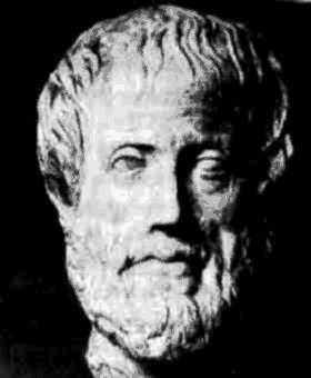 [335.16] points out that Aristotle consistently disagreed with his teacher, Plato. Aristotle’s geographical knowledge is highly suspect, claiming as he did that both the Danube and the Guadalquivir rose in the Pyrenees. However, it was Aristotle, revered by the Church, who maintained that the universe was earth-centred, a view that led to the persecution of Galileo and the burning of Giordano Bruno for their ‘heretical’ cosmological views.
James R. Smith wrote [1947] “First attempts at putting a dimension on the sphere are credited to Aristotle who recorded a diameter of 400,000 Stades. This figure could vary from 84,000 to 63,000 km, depending on our choice of conversion factor. But how he arrived at his value is unknown.”
According to Diogenes Laertius, Aristotle disagreed with his teacher on philosophical matters while Plato was still alive, causing Plato to remark, “Aristotle has kicked me, as foals do their mothers when they are born.” While there is evidence that Aristotle never lost his high personal regard for Plato, the fact remains that in his later writings, he never mentions Plato except to refute his doctrines, maintaining that the Platonic method is fatal to science.
Thorwald C. Franke refers specifically to Aristotle’s silence on the subject of Atlantis in his Aristotle and Atlantis[0706.30] in the following manner: “After all, if Aristotle were against the existence of Atlantis, one might have expected him to document his disagreement with Plato in some way and dispute the matter at hand. (Ingemar) Düring[1421] expresses what every person familiar with ancient literature knows well: ‘in accordance with the prevailing practice of that time, one mentioned the author of an opinion only if one did not agree … when it came to prevailing views with which he agreed, he [Aristotle] never mentioned the author.’
Thus the original argument is turned on its head: Aristotle’s very silence meant – if anything – more that he was for the existence of Atlantis than against it.”
My interest in Aristotle stems from the fact that he is constantly presented as the only classical writer to argue against the existence of Atlantis. A typical example is the comments of David Hatcher Childress who describes[620 .141]Aristotle as sceptical on many matters and that as well as doubting the reality of Atlantis he also appears to have questioned the veracity of Homer’s Trojan War when Strabo quotes Aristotle as saying that the Greek wall of Troy may never have been built but “invented and then demolished by the poet” (Geography XIII.i.36:).
However, Thorwald C. Franke‘s book, now published in English, persuasively disputes this commonly held view that Aristotle did not accept the existence of Atlantis. He points out that the alleged critical comment did not come directly from the writings of Aristotle but from a quotation attributed to Aristotle by Strabo (Geog. II 102). Franke has traced the use of this text as a dismissal of the existence of Atlantis by Aristotle back to 1816, when the French astronomer and mathematician Jean Baptiste Joseph Delambre (1749-1822) misinterpreted the commentary on Strabo’s Geographica by Isaac Casaubon in 1587.
Franke has recently augmented his book with a YouTube video, in English(d) and German(e).
Franke points out that a study of more than twenty passages from Aristotle’s writings relating to Atlantis reveals that he was inclined to accept the Atlantis story as true since he accepted many of its details without expressing any doubt about the core of it.
Jean Baptiste d’Anville (1697-1782) was a highly regarded geographer and cartographer, and also an Atlantis sceptic. However, as Franke has pointed out, d’Anville accepted that Aristotle believed in the existence of Atlantis[880.83].
In May 2016, there was held at the Aristotle University of Thessaloniki, in ancient Stagira and in ancient Mieza, an international conference ‘Aristotle 2400 Years’ at which it was claimed(a) that Aristotle’s long-lost tomb had been discovered at Stagira, his birthplace. Understandably, this generated an immediate critical response(b).
Aristotle, like others of his era is still highly regarded as a philosopher. Unfortunately, it took over a millennium before Ibn al-Haytham developed the concept of experimental data and the reproducibility of its results. On the other hand, Aristotle is not an ideal mentor regarding many subjects outside philosophy.
He was happy to justify slavery, as was Athenian society in general.
Aristotle was also a biologist whose work amazed Darwin when William Ogle sent him a copy of The Parts of Animals[1317] which he had translated. Now in The Lagoon[1318], a modern biologist, Armand Marie Leroi, reveals more of Aristotle’s wide-ranging scientific investigations and his conclusions, not all of which were correct(c).
(b) https://www.livescience.com/54923-archaeologists-doubt-aristotle-tomb-discovery.html
(c) Book: The Lagoon – Cosmos Magazine (archive.org)
(d) https://www.youtube.com/watch?v=inWb6IVNWFQ (English)
(e) https://www.youtube.com/watch?v=qDG7a09xkZE (German)