Latest News

Joining The Dots
I have now published my new book, Joining The Dots, which offers a fresh look at the Atlantis mystery. I have addressed the critical questions of when, where and who, using Plato’s own words, tempered with some critical thinking and a modicum of common sense.Read More »
Delos
Chatelain, Maurice
Maurice Chatelain is sometimes described as a French communications scientist who has worked as an engineer for a NASA sub-contractor,  and apparently left before the Apollo 11 landing on the Moon. He is the author of Our Cosmic Ancestors[1111], in which he made unsubstantiated claims about alien vehicles on our satellite(a). His UFO claims were debunked by Jim Oberg, who did work directly for NASA(b).
Chatelain also claimed that within a 450-mile radius of the Aegean island of Delos that there were 13 mystical sites, that when connected by straight lines formed a perfect Maltese Cross(c)!
He also drew attention to a huge number discovered on a Babylonian tablet discovered in the ruins of Nineveh. This number, 195,955,200,000,000, fascinated Chatelain, who went on to link it with both the Sumerian and Mayan calendars, referring to it as the Nineveh Constant. Rand Flem-Ath and Colin Wilson discuss this further in The Atlantis Blueprint [063.161].
His book also contains a chapter on Atlantis, which offers a brief overview of the subject before opting for the Bahamas as the location of Plato’s ‘island’.
(b) See Archive 3392
(c) https://www.mail-archive.com/ctrl@listserv.aol.com/msg28306.html
Geodesy
Geodesy is usually defined as the measurement and mapping of the Earth. James R. Smith, the author of Introduction to Geodesy [1947] has conflated several definitions to produce “Geodesy, from the Greek, literally means dividing the earth, and as a first objective, the practice of geodesy should provide an accurate framework for the control of national topographical surveys. Thus, geodesy is the science that determines the figure of the Earth and the interrelation of selected points on its surface by either direct or indirect techniques. These characteristics further make it a branch of applied mathematics, one that must include observations that can be used to determine the size and shape of the earth and the definition of coordinate systems for three dimensional positioning; the variation of phenomena near to, or on the surface, such as gravity, tides, earth rotation, crustal movement, and deflection of the plumb line; together with units of measurement and methods of representing the curved earth surface on a flat sheet of paper.”
Geodesy as a science can be traced back to Pythagoras (6th cent. BC), who was thought to be the first to propose the sphericity of the Earth. Aristotle & Archimedes were apparently the first to offer a figure for the diameter of the Earth, suggesting 400,000 and 300,000 stades, respectively. The difference might be partly explained by the use of a different length of stade.
Later, Eratosthenes (276 BC– 195 BC) offered another early attempt to determine the dimensions of our Earth and succeeded with remarkable accuracy.
A controversial aspect of modern geodesy is the claim that many ancient sites were deliberately established at locations that had a specific geodetic relationship to each other and/or the dimensions of the Earth. For example(a) in ancient Egypt, the distance from Giza to the Equator was calculated to be 1/12th the circumference of the Earth, Amarna to the Equator is 1/13th, Luxor 1/14th and Philae 1/15th!
Graham Hancock in his Heaven’s Mirror[855] pointed to similar relationships around the globe, suggesting a possible world grid. This idea of a world grid has a number of supporters, but is often classified as a ‘fringe’ interest, due to the attempt by some to link gridlines with UFOs and their use of the grid as a power source(w). Hancock’s various claims regarding the dimensions of the pyramids and their association with a suggested world grid has been challenged in great detail by a Hall of Maat article by Thomas W. Schroeder(ah). He concluded that “Graham Hancock’s assertion that the Great Pyramid’s dimensions reveal knowledge of earth’s dimensions certainly lacks proof but also fails to hold up to any scrutiny as a viable theory. Each step argued by Hancock; that the Great Pyramid was built to a specific scalar, that the value of the scalar can be definitively demonstrated, that the scalar indicates precession, that the only way ancient Egyptians could estimate precession is to leverage or borrow knowledge from earlier advanced and unrecognized civilizations, are each filled with flaws when taken individually, let alone when strung together to complete his narrative.”
The idea of a global grid has been pursued by a number of investigators, often with conflicting results. In the 1980s, William Becker and Bethe Hagens, published their widely referenced Planetary Earth Grid(aj). They “discussed the code of the Platonic Solids’ positions on Earth, ascribing this discovery to the work of Ivan P. Sanderson, who was the first to make a case for the structure of the icosahedron at work in the Earth. He did this by locating what he referred to as Vile Vortices refer to a claim that there are twelve geometrically distributed geographic areas that are alleged to have the same mysterious qualities popularly associated with the Bermuda Triangle, the Devil’s Sea near Japan, and the South Atlantic Anomaly.”(ak)
Possible related features may be the ley lines identified by Alfred Watkins in Britain(c)(g), the Alesia alignments in France discovered by Xavier Guichard(b) and/or the Heilige Linien of Germany, claimed by Wilhelm Teudt(aa) and supported by Henrich Himmler.
Xavier Guichard (1870-1947) is described as a Paris police chief and philologist. Between 1911 and 1936, he carried out an extensive study of French place-names and found that there were at least 400 sites with names derived from Alesia. When mapped, these hundreds of sites all lay on lines radiating from today’s town of Alaise, reminiscent of Alfred Watkins leylines! Francis Hitching, in The World Atlas of Mysteries [307.78] tells of how Guichard self-published his book, only to have his home bombed during the war in 1945, killing him and destroying most copies of his book. Elsewhere(b) the year of his death is given as 1947! Hitching included two maps reconstructing Guichard’s work.
Ashley Cowie has published a paper(ac) related to Alesia and the work of Guichard and others, as well as his own investigations.
Heinz Kaminski claimed to have discovered a megalithic grid system that stretched from Stonehenge across Europe with an east-west and north-south orientation and referred to as the Stonehenge/Wormbach System(h).
Even more exotic is the ancient Raetiastone navigation system rediscovered by Gerhard Pirchl (1942-2013) and outlined in a book by [1831] Thomas Walli(ae).
I should point out that Marcel Mestdagh also identified a form of a road system, laid out in giant ovals with radials in France. At the centre of these ovals was the ancient city of Sens. Philip Coppens informs us [1275.184] that a further strange discovery by Mestdagh, was that this ancient road network, centred on Sens, was mirrored by a similar network of roads in England, centred on Nottingham!
‘The Way of Virachoca’ in the Andes, which runs through Tiwanaku and is oriented exactly 45° west of true north and runs for over 1000 miles, it has been studied by Maria Scholten d’Ebneth [1236] in the 1970s and expanded on by a number of Spanish speaking commentators and is now the subject of an article by Dave Truman(x).
In 1973, three Russians, engineers Valery Makarov and Vyacheslav Morozov, along with Nikolay Goncharov, an artist, published an article in Russian with the eye-catching title of, Is the Earth a Giant Crystal? (y) This was probably the earliest presentation of an earth grid based on ancient historical sites. A brief history of the Earth grid theories that emerged around this time is available online(z). There is now a Russian geodesy website with an English translation(ab).
David Hatcher Childress published his Anti-Gravity and the World Grid [1303] in 1993, with the modest claim that he “proves that the earth is surrounded by an intricate electronic grid network offering free energy.” Obviously, Childress’ understanding of ‘proof’ is different to mine, as the only proof required is the production of some of this free energy, which he has not done.
Tom Brooks(ai) entered the fray with a study of 1500 prehistoric sites and his conclusion that the inhabitants of ancient Britain had designed a navigation system based on a grid of isosceles triangles(i). Brooks has gone a step further and speculatively claimed that the accuracy of this geometry-based system could only have been designed through “extraterrestrial intervention”(r). This concept is explored more fully in his latest book, Seeing Around Corners: Geometry in Stone Age Britain [863] and in a series of video clips(s). A more critical view of Brooks’ ideas is also available on the Internet(j).
Some years ago, a former employee of a NASA sub-contractor, Maurice Chatelain, claimed that within a 450-mile radius of the Aegean island of Delos, 13 mystical sites, when connected by straight lines formed a perfect Maltese Cross(u)!
Others such as Livio Stecchini(d) and Jim Alison(e) using geodetic calculations, have identified São Tomé and Cape Verde, respectively as the location of Atlantis. I must also include Hugo Kennes, a Belgian researcher with a passionate interest in global grids and sacred geometry(l). Kennes has also informed me of a new Facebook group(q) which deals with all aspects of the subject, as well as another(v) that includes submerged cities and other features.
Anyone interested in pursuing a study of this subject might like to look over James Q. Jacobs’ archaeogeodesy website(f) as well as the BioGeometry website (m).
If you have pursued all the links so far, you can pamper yourself further with a paper(k) by William Becker and Beth Hagens(n). Another researcher in this field is Dan Shaw, whose website(o) gives a good overview of the subject.
Jean-Pierre Lacroix added his weight to the debate with his 1998 paper entitled, The Mapmakers from the Ice Age(t).
A global network of sacred sites was also put forward by Rand Flem-Ath & Colin Wilson in, The Atlantis Blueprint [063]. This book was intended as a sequel to, When the Sky Fell [062], but it generally wandered off into other areas after the first couple of chapters.
I am somewhat sceptical about certain aspects of geodesy, particularly some of the claims of a world grid. However, it does raise many questions that require further study and explanation. In this connection, I would recommend John Sase’s, Curious Alignments [1589] as a good starting point. He confirms the work of Guichard and also offers a range of his own discoveries in the Great Lakes region.
In February 2020, Frank Maglione Nicholson, Ken Phungrasamee & David Grimason, collectively known as The Nazca Group(ad), published, The Nazca Great Circle Map Hypothesis. Their claim is that “The lines and geoglyphs carved into the Nazca plateau represent a map of the Earth. The map is a Great Circle Map: a gnomonic projection, with the center of the Earth as its cartographic viewpoint. Each line on the Nazca Plateau represents a great circle of navigation centred at the centre of the Earth and encircling the entire planet. The majority of the lines on the Nazca Plateau radiate from five loci of origin called radial centres.” I found this rather esoteric proposition difficult to absorb.
Arturo Villamarin has published many books [1864] and papers(af)(ag) in which the geometry and astronomy of archaeological monuments; Göbekli Tepe, Stonehenge, Teotihuacán and Mohenjo Daro, among others, are discussed.
(a) http://www.ancient-wisdom.com/geodesy.htm
(b) http://www.ancient-wisdom.com/xavierguichard.htm
(c) http://www.ancient-wisdom.com/leylines.htm
(d) http://www.metrum.org/mapping/atlantis.htm (link broken Dec. 2020)
(e) http://home.hiwaay.net/~jalison/concl.html
(f) https://web.archive.org/web/20200917015056/http://www.jqjacobs.net/index.html
(g) https://liminalthresholds.blogspot.ie/2008/04/earth-energy-ley-lines.html
(i) See: https://web.archive.org/web/20160628154229/https://www.prehistoric-geometry.co.uk/
(j) https://www.badscience.net/2010/01/voices-of-the-ancients/
(k) https://www.bibliotecapleyades.net/ciencia/antigravityworldgrid/ciencia_antigravityworldgrid02.htm
(m) https://web.archive.org/web/20170328094319/https://www.biogeometry.org/page34.html
(n) Bethe Hagens – Geometry, Anthropology anf the Arts of Consciousness (archive.org)
(o) https://www.vortexmaps.com/grid-history.php
(q) https://www.facebook.com/groups/175027289350368/
(r) https://www.prehistoric-geometry.co.uk/ [See (i)]
(s) https://www.youtube.com/watch?v=R35A80kV0AU&feature=relmfu
(t) https://ancientcartography.net/geoAN.html
(u) https://www.mail-archive.com/ctrl@listserv.aol.com/msg28306.html
(v) https://www.facebook.com/groups/493298404177687/
(x) https://grahamhancock.com/trumand1/
(y) http://web.archive.org/web/20220819135530/https://atlantipedia.ie/samples/archive-3193/
(z) https://www.vortexmaps.com/grid-history.php
(aa) https://www.cantab.net/users/michael.behrend/repubs/teudt_hl/pages/index.html
(ac) Solstice Axis Of The Ancient Gauls — ASHLEY COWIE (archive.org)
(ad) The Nazca Solution – The final solution to what the Nazca Lines represent (archive.org)
(ae) https://www.megalithic.co.uk/article.php?sid=2146413597
(ag) (99+) (PDF) THE GEOMETRY AND ASTRONOMY OF GOBEKLI TEPE | Arturo Villamarin – Academia.edu
(ai) https://www.megalithic.co.uk/article.php?sid=2146413745
(aj) Microsoft Word – antigravity.doc (montalk.net)
(ak) https://www.crystalinks.com/grids.html
Malta
Malta is a small, densely populated (575,000) archipelago and is roughly one-fifth the size of Rhode Island (pop. 1.1 million).
It is strategically situated in the Central Mediterranean between Sicily and Tunisia. There is a claim that early Maltese were Phoenicians who came from Lebanon around 3000 BC(i). It was reported in 2007 that nearly 30% of “modern-day Maltese share a genetic link with the ancient Phoenicians.” (ay)
However, the Phoenicians do not appear to have been the first, as temple building on the islands began centuries earlier and before that, there is evidence to show a Neanderthal presence there (See below).
At a 2003 Conference in Malta Anton Mifsud concluded his paper(at) entitled Ancient Maltese Skulls – Disease, Genetics and Population Migrations with the following,
“In conclusion, it would seem that this earliest evidence of the genetically determined and transmitted disease known as Thalassaemia in Malta five thousand years ago contradicts the present view that the earliest immigration into Malta derived from Sicily in 5200 BC. The study of genetic distances and ancient population migrations rather points to much earlier immigration of humans from North Africa into Malta and onto Europe around 43,000 BC. Archaeologically documented human remains and artefacts dated to this period of time lend further support to this view.”
It was not until the 1st millennium BC that there was a formal occupation of Malta by the more militant successors of the Phoenicians, the Carthaginians and many centuries later, the Knights Templar.
Nowadays, Malta has a highly recognisable national flag adorned with an eight-pointed cross, universally accepted as Maltese. However, this symbol has a long history and greater geographical spread than generally realised. Gary A. David has written an informative paper(af) on the Maltese Cross and its variants as found around the world. He pointed out its use in the Americas by the ancient Olmecs and has laid great emphasis on its place in the inherited culture of the Hopi Indians.
An unexpected reference to this national symbol can be found in the writings [1848.71] of Maurice Chatelain, an ancient astronaut theorist, who claimed that within a 450-mile radius of the Aegean island of Delos, there were 13 mystical sites, which, when connected by straight lines, formed a perfect Maltese Cross(ah)!
It is claimed by some that the name ‘Malta’ is derived from the Phoenician word ‘Maleth’, meaning refuge. However, the name is more generally accepted to be taken from the Greek word for honey, meli, and was later known to the Romans as Melita, the Latin equivalent. Malta was renowned in ancient times for the quality of its honey, which may explain why the light-fingered, 1st century BC Roman governor, Verres, stole 400 amphorae of it (about 2800 gallons) over three years.
Eire Rautenberg offers a more speculative Malta/Bee association, claiming “The first humans came 11,000 – 6,000 BC. BC, historically very early. ‘Malet’, the Punic name for Malta , means refuge and the Greek interpretation ‘Melita’ of -melas means a honeyed dark goddess. The bee structure of the Megalithic Temples of Malta everyone can study at the temple stones; they sometimes look like huge honeycombs that have been proven to be artificially created. The owl as a symbol of the dark, all-seeing eye goddess can also be found on a stele of the megalithic temple Hagar Qim on the southwest coast”(av).
Antoine Gigal has drawn attention to “an even closer link with Egypt. The former name of Malta is Melita, from the Latin mel, ‘honey’. The symbol of Malta is a bee with its hexagonal honeycomb. Let us not forget that the symbol of the pharaoh in Egypt is also the bee (‘bit’) which gives him one of his titles. Honey was reserved for the Pharaoh and the chief priests, and Mel (or Mer) was one of the names given to the pyramids in Egypt. In addition, sun worship prevailed in Malta as in Egypt, and the dolichocephalic caste disappeared at the same time in both countries. In my own research, I’ve found that there was very probably a migration of these long-headed people from Egypt to Malta, and traces of them are found in Cretan civilization.”(al)(see below &(ak))
Malta, for most Christians, is where St. Paul was shipwrecked on his way to Rome, but even this is disputed by the inhabitants of Mljet in the Adriatic, who make an identical claim. This is not the only serious controversy concerning St. Paul that has arisen. His actual existence has been called into question, or at the very least, the age in which he lived, in an article by a chronology revisionist, Gunnar Heinsohn, entitled Saint Paul: Did he Live Once, Thrice or Not at All(ar)?
Today, Malta is a stepping-stone between North Africa and Europe. At the time of the last Ice Age, it was probably joined to Sicily, but whether it was also joined to North Africa is a matter for debate. This possibility depends on the extent to which the level of the Mediterranean was lowered by the 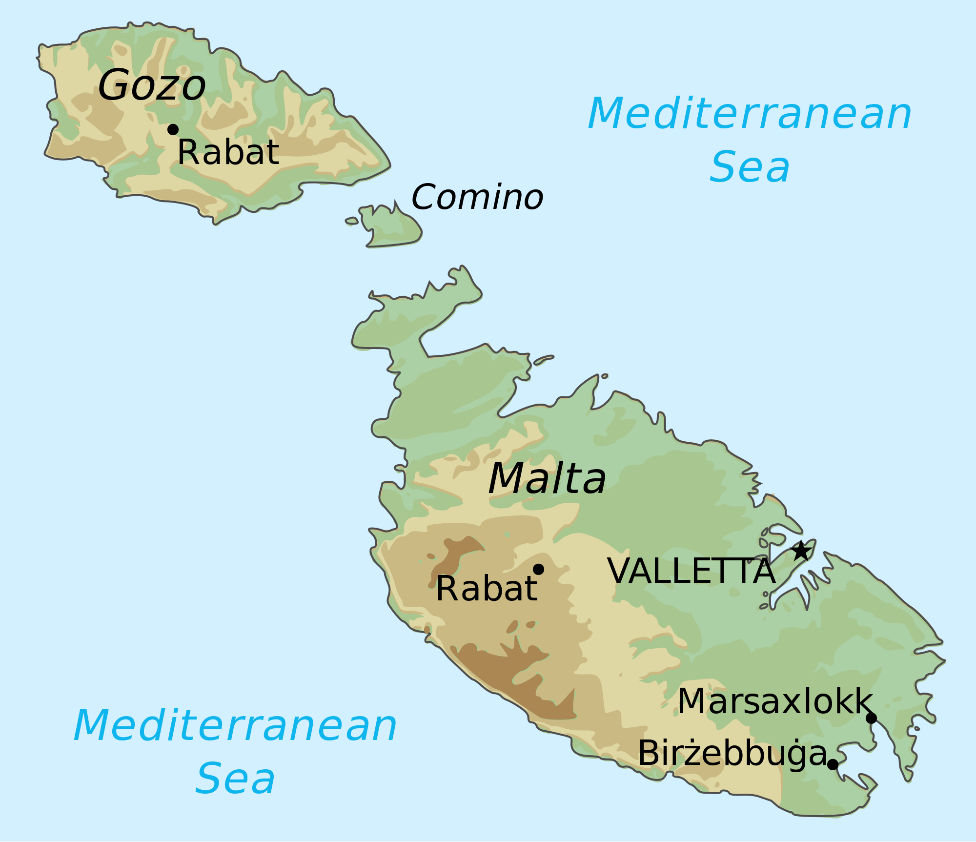 growth of the Ice Age glaciers and whether that lowering was exacerbated by the existence of a land bridge between Southern Spain and Morocco. Vittorio Castellani offers[224] a possible map of the enlarged Sicily extending to include the Maltese Islands, leaving a narrow strait between an expanded Malta and the coast of Tunisia. Dr Anton Mifsud has researched ancient maps of the Central Mediterranean region and demonstrated that the early cartographers knew the Maltese archipelago as having a much larger area than at present. G.N. Godwin expressed similar views regarding an earlier enlarged Maltese landmass in his Guide to the Maltese Islands [1592].
The Greek text describes Atlantis as being ‘pro’ in front of or before the Pillars of Heracles rather than ‘meta’ beyond them, which would fit a description of Malta being in front of (east of) the Pillars if as suggested, they were located at the Strait of Sicily.
Commenting on this proposition, J. Warren Wells points out that “Plato uses ‘pro’ seven times in Timaeus and twice in Critias. In eight of these cases, it is used in relation to ‘time before’ rather than ‘place before.’It is used only one time in relation to place or position. That single occurrence is where he refers to the island of Atlantis being before (pro) the straits at the Pillars of Heracles.” He concluded that at the very least, close proximity is implied[783].
W.K.C. Guthrie in A History of Greek Philosophy (Vol.5, p245)[946] comments similarly – “before the entrance’ I take to mean that it was at no great distance, but the volcanic Azores have a better geographical claim to be the remains of Atlantis than any spot within the Mediterranean.”

Dr Anton Mifsud
Guthrie recognised that Plato was describing the island of Atlantis as being near the Pillars of Heracles, but based on the assumption that the Pillars were situated at Gibraltar, he was forced to opt for the Azores as the location of Atlantis, even though at a distance of 1,100 miles they cannot in any way be described as being “at no great distance” from the ‘Pillars’. Consideration of other known locations, particularly in the Central Mediterranean, that was also, at different times, designated as the Pillars of Heracles, show several islands, including Malta, close to each nominated site.
Malta is home to some of the earliest and most spectacular megalithic monuments in Europe, with some finely carved art, particularly spirals as can be seen in Michael Ridley’s book[1711]. Unfortunately, many more have been lost. Lenie Reedijk in her recent book, Sirius – the Star of the Maltese Temples [1631], lists 100 megalithic sites on Malta & Gozo, of which two-thirds have been lost [p.14/15]. She also contends that the temple building in Malta was spread over a much longer period than generally accepted, beginning as early as 9150 BC and lasting until 4250 BC.
A 2022 paper(ax) by Huw S. Groucutt et al. explores the apparent abrupt ending of the Temple Building Period in Malta and its coincidence with what is known as the 4.2 ka Event, when many societies collapsed in the Mediterranean region. The paper discusses the possible causes, including climate change, which seems to be the most advocated explanation. However, conflicting opinions combined with a shortage of data have prevented the authors from arriving at a firm conclusion. Nevertheless, this paper is a useful addition to the literature on the subject.
2200 BC, is also the date for the destruction of Atlantis, ln Malta, proposed by Anton Mifsud.
Many attempts have been made to link the orientation of the temples with various astronomical bodies. A limited study by John Cox proposed a connection with moonrise (t). Mario Vassallo favours an association with the winter solstice sunrise(u). Klaus Albrecht also identifies [1632] the winter solstice sunrise as his preferred orientation(v). Reedijk offers a far more radical explanation for the alignment of all the temples, namely that they were directed at Sirius, the brightest star in the night sky at that time. However, precession slowly broke that alignment. Reedijk noted that “a star whose rising and setting point was aligned with a temple axis of a given monument at a given time will have moved out of its line of sight in the course of several centuries. When this happened the need would have been felt to build another monument with a slightly different orientation of its main axis, in order to be in line with the star again.”
What I do not understand is why, according to Reedjik, the Maltese temple builders continued to build their re-aligned monuments for over five millennia without simply modifying existing temples rather than engaging in the immense work involved in starting from scratch after every failure of orientation.
Tore Lomsdalen has an MA in Cultural Astronomy and Astrology from the University of Wales Trinity Saint David. He is now studying for his PhD in archaeology at the University of Malta. He has published several papers on the orientation of the Maltese temples some with a particular focus on Mnajdra(am)(an). He has now added a paper on the Academia.edu website on the possible use of archaeoastronomy to assist with the development of a building chronology for the temples at Mnajdra(aq).
In September 2021, a Canadian researcher, Irene Friesen Wolfstone, published a paper(ao) in which she “hypothesizes an Afrocentric origin for the astronomical knowledge that informed the megalithic temple builders of Malta.” and explained that “using a cosmological epistemology, I hypothesize the cosmological principles that were expressed in the astronomical and matricentric design of Mnajdra.”
In the December 1995 edition of Earth-Science Reviews, an article by Janpieter Van Dijk and P.J.J. Scheepers, discussed the evidence for tectonic rotation in the Central Mediterranean(az). Some years later, Carmelo Raymond Sant revisited this subject in the context of the Maltese Islands and the orientation of its remarkable temples.
Sant is a retired engineer and the author of two books [1701/2] concerning the Maltese temples and their function as calendars, which are supported by a fully illustrated website(y). His intense study of the temples and the evidence that over time their orientation changed led him to conclude that within human experience, some form of tectonic rotation south of Sicily has taken place. To quote Sant, “two main anomalies became evident in the megalithic calendar. The first obvious one was related to alignment. Unknown geological events had taken place, which contradict the established view on plate tectonics (see micro-plate rotations). The second concerns Earth dynamics. The evidence in the design hints strongly to abrupt changes in the Earth’s axial tilt, in contradiction to established thinking.“(z)
Another Maltese writer who is sympathetic to the idea of Atlantis in the region of Malta is Joseph Serracino, as revealed in a brief article(as).
Malta is home to some of the earliest and most spectacular megalithic monuments in Europe. Dr Mifsud has pointed out that the size and number of these ancient monuments are greater than an island of Malta’s present extent could be expected to produce. This view, when combined with the mysterious ‘cart-ruts’ that run straight off cliffs, and then reappear on the opposite side of a bay or across open sea, all point to Malta having been a much larger landmass within the experience of man, namely, not earlier than 5000 BC. The cartruts.com website shows(d) the possible shoreline of Malta at 5000 BC and 8000 BC. The same site has a page on ‘torba’ an alleged prehistoric Maltese cement. The tiny island of Filfla three miles off the south coast of Malta, had cart ruts visible on it before it was used for target practice by the British military(g). The clear implication was that it had been connected to the main island while it was inhabited. Furthermore, three miles offshore from Sliema on the north side of Malta submerged ruins of what is thought to be a temple (now named ‘Gebel Gol-Bahar’)(h) were discovered in 1999.
I expect that further discoveries will be made, but as it is, there is sufficient evidence to prove that when it was initially settled and certainly as late as some of the Temple Period, the archipelago had been considerably greater in extent than today. A short history of Filfla is worth a read(o).
An underwater study (2013) of the seafloor between Malta and Sicily revealed that the archipelago had been connected to Sicily by a 40 km wide land bridge, now submerged by rising sea levels following the last Ice Age(w).
In 2010, a former co-author of Mifsud’s, Charles Savona-Ventura, rather strangely, independently published a fourteen-page booklet, In Search of Atlantis[1332], in which he reiterated his support for Malta as Atlantis!
In 2014, it was reported(k) in the Times of Malta that a huge underwater canyon, previously unknown, with an extent eight times the size of the Maltese Islands, had been discovered in an area known as the Malta Escarpment. It was also found that the canyon had been active recently, highlighting the geological instability in the region. (The link below includes a short video clip).
In 1923, R. M. Gattefossé commented [314] that many of Malta’s ancient monuments were “Atlantean” in character, although he believed that Atlantis had been located in the Atlantic. Dr Mifsud attributes the earliest linking of Malta with Atlantis to the 16th-century writer, Bibischok. His manuscript is held in the National Library of Malta in Valletta.
However, it was over three hundred years before the suggestion was made again, when an anonymous German writer using the nom-de-plume of ‘Anacharsis’ published (in German only) a Handbook for Educated Travelers through Southern France, Switzerland, Italy and Greece to Corfu, Volume 2 ” published in 1839 (p. 109-112). The author, who is still unidentified, suggested that the Maltese archipelago was the tip of a great sunken land, probably Atlantis(au).
Shortly afterwards, in 1854, Giorgio Grongnet de Vasse, the renowned Maltese architect, proposed that the Maltese Islands were remnants of Atlantis.
In 1910 the celebrated Maltese botanist, John Borg offered the opinion that Atlantis had been situated on the submerged land between Malta and North Africa [1132].
D. H. Childress reports that in 1922, the archaeologist Joseph Bosco, also supported this idea. Three-quarters of a century passed before the idea of a Maltese connection with Atlantis was again revived, in particular by the publication of two books, one by Anton Mifsud[209] and the other by Francis Galea[308], in English and Maltese, respectively. Both of these books are the result of extensive investigation and have inspired others to continue their study. Graham Hancock was prompted to visit the island and gained material there for his popular book[274] on ancient flooded cities.
Mifsud is widely accepted as Malta’s leading atlantologist and was the principal author of Malta, Echoes of Plato’s Island, in which a very strong case was made for considering Malta as Atlantis. In 2017, he published Island of the Gods[1671] (available on the academia.edu website), which strengthened his Atlantis theories with complementary material. As can be seen from the bibliography here, Mifsud has written several books and papers concerning the history and prehistory of this strategically situated island and the endless procession of traders and occupiers – Neanderthals, Megalith Builders, Egyptians, Phoenicians, Carthaginians and Romans.
Another contributor to the study and literature of the island’s prehistoric origins that should be mentioned is the late Joseph S. Ellul. He was a Maltese teacher and the author of a paper, Malta’s Prediluvian Culture…,[289] linking the submergence of some of Malta’s monuments with Noah’s Flood, which he identified with the controversial idea of the breaching of a land bridge between Spain and Morocco.
While most researchers have focused on the extraordinary number of ancient monuments on the small archipelago, it might be worth considering what is not found on the islands, namely, anything to do with military action. There are no obvious defensive structures and no depiction of warriors or their weaponry. Everything seems to indicate a peaceful society, perhaps, as I and others have already speculated, it was originally a place of pilgrimage(m)(n) or some form of sanctuary!
Hubert Zeitlmair, a retired German real estate investor, is fascinated by the Megalithic remains on Malta, but unfortunately, he ascribes their existence to the intervention of alien visitors, a la Zechariah Sitchin. He has outlined his views in a book[465], written in German, with an English version promised in the future. Zeitlmair expands on a number of his outlandish claims on his website(f), UFOs, Nibiru, as well as “the Atlantean ‘Cold Fire Fusion’ Power house in Malta that still generates Non-lethal High-Frequency Active Auroral Energy.” Similar waffle has been published in the first two books[783][947] of a trilogy by the late Francis Xavier Aloisio, who claims that the Maltese temples “are a Reservoir of Consciousness, so we need to start to look at the structures in a very different way. They were ‘charge compressors’, ‘energy generators’ and ‘power houses.’ In a word, they were ‘energy centres’ for planet Earth.”
Quite recently, Aloisio’s wife, Christine, also joined the ‘lunatic fringe’ and published The Crystal City of Atlantis [1846], which she claims is under Malta. The promotional blurb tells us how “The reader is taken through a remarkable chronicle of how they found Ashua.ra.ta.ra, the Crystal City of Atlantis and met the High Priest who shares with the author his wisdom and describes their Inner Earth Kingdom. The High Priest also reveals how he and his fellow Atlanteans fled there, after the last devastating flood of Atlantis.” For good measure, the author reveals that Lemuria had been situated in California in ancient times!
Anton Mifsud has noted that “Without the use of metal, the ancient Maltese were erecting the first domed structures of the world; these sanctuaries were also being built in accordance with an anti-seismic blueprint, and, amongst other designs, most if not all of these temples incorporated highly advanced acoustics that is still retained in the ‘closed’ surviving framework at the Hal Saflieni Hypogeum”(ab) Glenn Kreisberg, is an American researcher, who has investigated archaeoacoustics and has visited the Hypogeum and carried out experiments there(ac).
Linda Eneix has some interesting additional comments about the acoustics of the 5000-year-old Hypogeum and for good measure, touches on the archaeoacoustics of Newgrange and Göbekli Tepe. Considering acoustics in general and music in particular, she adds, “Harvard Medical School neurologist and psychiatrist David Silbersweig says that music activates many different parts of the brain. The revelations are stunning but none so exciting as one from Johns Hopkins University, where researchers have identified a relationship between music and dopamine release.” (aw).
In 2020, it was announced that acoustic engineers from the University of Salford had demonstrated that Stonehenge had acoustic qualities that allowed “any sounds produced inside the temple would have been much less audible to anybody outside the circle, despite the monument almost certainly not having a roof.
The findings, therefore, suggest that any sounds generated by activities carried out inside the circle were not intended to be shared with the wider community. This reinforces theories suggesting that the potential religious activities conducted inside Stonehenge were reserved for an elite of practitioners, rather than for a wider communal congregation.”(ad)(ae)
Casey Terry notes [1542.36] that Pavel Smutny, a Czech researcher, who is an ardent promoter of the idea of ancient advanced technology, has gone further and proposed that the Maltese temple complexes “were used probably as generators of high-frequency acoustic waves. The purpose was (maybe) to arrange a communication channel between various islands”!(ag) A similar claim regarding the Maltese temples as acoustic communication centres is to be found in a paper written by Glenn Kreisberg (ab).
Another site(aj) noted that “There is no denying that a sophisticated school of architectural knowledge was already in place a thousand years before the Egyptians started building pyramids. (The same people who created Hal Saflieni also engineered a complete solar calendar in one of their above-ground megalithic structures, with solstice and equinox sunrise alignments that still function today.)”
The Hal Saflieni Hypogeum, mentioned above, has produced a mystery, a controversy and an accusation of conspiracy. When it was excavated, several longheaded skulls were found. However, since the middle of the 20th century, most of these skulls have quietly vanished. Fortunately, Dr Anton Mifsud has not let the matter rest and tracked down some of these and in a detailed publication(ak) has explained: “that they have been intentionally hidden from the general public for various reasons, political, national and cultural, for over a century.” Mifsud has now published the fourth(ap) in a series of books on these long-headed skulls and, no doubt to the disappointment of some, he concluded that “the Hal Saflieni Hypogeum skulls are alien, alien to the norm, but not alien as in extra-terrestrial.” Part three has already been published(ak) and parts one and two are in preparation.
The most recent and more rational support for a Maltese location has come from Albert Nikas, a computer engineer, who submitted a paper(b) to the 2008 Atlantis Conference. Sunday, November 19th, 2017, saw the publication of an article(l) by Nikas in Malta’s Sunday Independent, in which he describes his recent visit to many temples in the archipelago. He goes on to claim that he has located the ruins of an ancient city, just offshore, which he believes to have been the capital of Atlantis, not far from Valletta, the modern capital.
Nikas reported his findings to Heritage Malta, providing them with images and coordinates, but had no positive response. Nika is anxious that the site be confirmed by the authorities and then secured, but the apparent lack of interest from that quarter prompted him to conclude his article with the promise that “if I don’t hear anything from the authorities within a short time I will be obligated to reveal the location of the find to the Maltese people, after all, it is part of their history and they have the right to know about it”. No such revelation appears to have been made and no further comment has emanated from Nikas!
Massimo Rapisarda submitted another paper to the same conference, suggesting that Atlantis had been located in Sicily in the vicinity of the seaport of Marsala. That conference also heard Axel Hausmann identify a region which included part of North Africa and the area between Libya and Sicily as the home of Atlantis.
Alberto Arecchi, who also advocates a Central Mediterranean Atlantis, noted that “We can identify in this system the “Heracles’ columns” of the ancient mythology (one of the two “columns” appears identifiable with the island of Malta).” (s)
I do not know what future investigations will reveal, but I am certain they will demonstrate that Malta had a  more important part to play in the Atlantis story than is generally accepted today. The megalithic heritage of Malta predates that of Egypt by a millennium, considerably enhancing its candidacy as the location of Atlantis or at least part of that confederation. A wonderful panoramic view of some of the temples can be seen on the Internet(c).
The second largest of the Maltese archipelago, Gozo, is claimed by some to have been Ogygia, the home of the mythical Calypso. Today, there is a cave overlooking Gozo’s Ramla Bay which, by tradition, is thought to be “the one where the beautiful nymph Calypso keeps Odysseus as a “prisoner of love” for seven years.” (x)
Gozo also claims to have the oldest free-standing temples in the world, known as Ggantija. In the early 19th century, a Danish-German artist painted a number of watercolours of the Ggantija area that “show stones and reliefs that have since been destroyed” (ai).
Many websites discuss the prehistory of Malta(a). One well-illustrated site(e) concentrates on the evidence of catastrophic events affecting the landscape of the archipelago in the distant past. A newspaper report of June 2016(j) pushes back the prehistory of Malta by 30,000 years, with the claim that Neanderthals may have lived on the island, assuming that it was an island then! In 2016, Mifsud published Dossier Malta – Neanderthal [1587] in which he outlines the evidence for the existence of Neanderthal Man on Malta.
Malta also produces a Cabernet Sauvignon wine in the town of Marsaxlokk, appropriately, but not uniquely, called Atlantis.
On Sunday, January 13th, 2019. the UK’s Sunday Express delighted its readers with TWO Atlantis stories(q)(r). The online edition of the paper offered a video clip of the Maltese island of Filfla, while the commentator told us that Plato had said that a devastating earthquake had destroyed Atlantis, which was finished off by an eruption. This is factually incorrect, as Plato never mentioned an eruption. Then, as if that was not enough, the same edition of the same newspaper has another story by the same ‘reporter’, with an ‘Atlantis Discovered’ headline, claiming that the remains of an ancient 8,000-year-old city, home to ‘tens of thousands’ of people, had been discovered in the North Sea, in a huge region sometimes referred to as Doggerland. The reporter cites Dr Richard Bates in support of this account. Unfortunately, the 2012 comments by Dr Bates never mentioned ‘a city’, only a vast area occupied by ‘tens of thousands’ of people, presumably early farmers(p). These two accounts are a sad reflection of the quality of media reporting today.
I cannot leave this subject without mentioning Julian Cope’s, The Megalithic European [1780], described as “the most extensive study of European megalithic sites to date.” This beautifully illustrated book offers information on 300 sites, including Malta, visited by the author, some of which were new to me.
In 2025, the idea of Atlantis in Malta was given another airing by the Dutch researcher Philip I. Venema in a paper and YouTube clip(bb) entitled Atlantis Reclaimed. Overall, I was not convinced by many of his claims, even though I have also written in support of a Central Mediterranean Atlantis.
His investigation was prompted by the mysterious cart ruts found all over the archipelago. As I explain elsewhere, although there are many unanswered questions relating to the cart ruts, any suggestion that there is a connection with Atlantis is just unfounded speculation. Furthermore, it ignores the fact that cart ruts have been found in many European countries and as far east as Azerbaijan, although not as numerous as on Malta. Venema contends that the vehicles used to create the cart ruts were non-axial, a claim contradicted by an image published(ba) in 2017 that appears to show where axles have worn into a raised stone wall at one side of a rut.
However, my principal objection to Venema’s hypothesis is that his timeline makes no sense. He proposes that between 9500 and 7000 BC, a series of ecological disasters forced the Atlantean people of Malta to migrate. Some headed to the Nile, bringing with them the story of Atlantis, which the Egyptian priests preserved and much later transmitted to Plato via Solon. Plato’s account tells of the Atlanteans attacking Athens, which does not seem possible before their dispersal as Athens did not exist that early, nor could they have attacked Arhens, after arriving in what became Egypt, as Plato tells us that Athens was responsible for defending it from an invasion by Atlantis. Something is wrong here.
Venema frequently cites the work of Anton Mifsud, among others and borrows Mifsud’s suggestion that two giant limestone stacks at the promontory at Ras ir-Rahed were the Pillars of Herakles referred to by Plato. However, as Venema has been at pains to point out, the Central Mediterranean region is very unstable and prone to catastrophic seismic/tectonic disturbances leading to the extensive loss of land, which in turn gave us cartruts ending on cliff edges, or heading under the sea. Consequently, it is unlikely that the stacks at Ras ir-Rahed would have remained intact over the millennia since the time of Atlantis, apart from which these limestone ‘pillars’ only appear like pillars when viewed from one direction.
Venema also highlights the case for a strong Malta-Egypt association, citing an Egyptian cemetery in Malta, but does not mention any Maltese burial sites in Egypt! In short, Venema is guilty of excessive speculation, his timeline is flawed and evidence is weak.
For an overview of Malta’s history See [1714], [1713], [1715] and [1716].
See Also: Mediterranean Sea Level, Axel Hausmann, Kevin Falzon.
(a) Prehistory about malta, from stone age to bronze age (archive.org)
(b) https://atlantisinmalta.blogspot.ie/
(d) See: https://web.archive.org/web/20190102032648/https://cartruts.com/
(e) Was Malta the island of Atlantis, the island of Temples that had a Catastrophe? (archive.org)
(f) See: https://web.archive.org/web/20160401190453/https://www.maltadiscovery.org/en/
(g) http://www.ancient-wisdom.com/cartruts.htm
(h) ?ebel ?ol-Ba?ar – Wikipedia
(i) https://web.archive.org/web/20180810185353/https://kadmous.org/wp/malta-and-lebanon/
(m) See: https://web.archive.org/web/20160823204054/https://www.templesofmalta.com/ggantija.htm
(o) https://www.guidememalta.com/en/all-you-need-to-know-about-the-mysterious-islet-of-filfla
(p) (BBC July 4, 2012) https://www.bbc.com/news/uk-scotland-edinburgh-east-fife-18687504
(t) https://academic.oup.com/astrogeo/article/49/1/1.7/307209
(u) ‘The Location of the Maltese Neolithic Temple Sites’, Sunday Times, 26 August 2007, pp. 44–46.
(v) https://www.geestkunde.net/tabula-smaragdina/malta-tempels-aardgodin.shtml
(w) Largest part of the Maltese islands is today under water – study – MaltaToday.com.mt (archive.org)
(y) Melitamegalithic (archive.org) (slow to load)
(z) About – Melitamegalithic (archive.org)
(aa) https://migration-diffusion.info/article.php?id=530
(ab) https://www.academia.edu/39950048/THE_ELITE_LONGHEADS_OF_MALTA?sm=a
(ac) https://grahamhancock.com/kreisbergg6/
(ae) https://phys.org/news/2020-09-uncovering-acoustical-properties-stonehenge.html
(af) https://www.academia.edu/8661701/The_Maltese_Cross_Hopi_Indian_Version_of_a_Knights_Templar_Symbol
(ag) https://www.academia.edu/36532579/malta29042018_odt
(ah) https://www.mail-archive.com/ctrl@listserv.aol.com/msg28306.html
(ai) Goddess History by Marija Gimbutas (archive.org)
(aj) Search for Archaeoacoustics Malta Select Archaeoacoustics – The OTS Foundation for Neolithic Studies
(ak) https://www.academia.edu/43811237/THE_MISSING_HYPOGEUM_SKULLS_OF_HAL_SAFLIENI
(al) EGYPT BEFORE THE PHARAOHS (gigalresearch.com)
(am) (99+) (PDF) Astronomy and Intentionality in the Temples of Mnajdra.
(ao) (99+) Mnajdra: Cosmology of the Sky | Irene Friesen Wolfstone – Academia.edu
(ap) (99+) (PDF) HAL SAFLIENI HYPOGEUM – THE ALIEN SKULLS | Anton Mifsud – Academia.edu
(ar) https://q-mag.org/st-paul-did-he-live-once-thrice-or-not-at-all.html
(as) https://timesofmalta.com/articles/view/is-malta-really-part-of-atlantis.35351
(at) https://www.academia.edu/3270896/Ancient_Maltese_Skulls_Disease_Genetics_and_Population_Migrations
(au) Malta was Atlantis – Atlantisforschung.de (atlantisforschung-de.translate.goog)
(av) Poseidon is not a Greek god! – Atlantisforschung.de (atlantisforschung-de.translate.goog)
(aw) https://www.academia.edu/63669239/Megaliths_Music_and_the_Mind_The_Latest_in_Archaeoacoustics
(ax) (PDF) The 4.2 ka Event and the End of the Maltese “Temple Period” (researchgate.net)
(ay) One-third Of Maltese found to have ancient Phoenician DNA – The Malta Independent
(ba) https://michael-chen-mg2n.squarespace.com/news/2017/6/22/maltas-cart-ruts-proof-of-ancient-advanced-civilizations (fourth image down)
(bb) https://www.youtube.com/watch?v=yrj8AUfptuE
(bc) Philip Venema {7658}