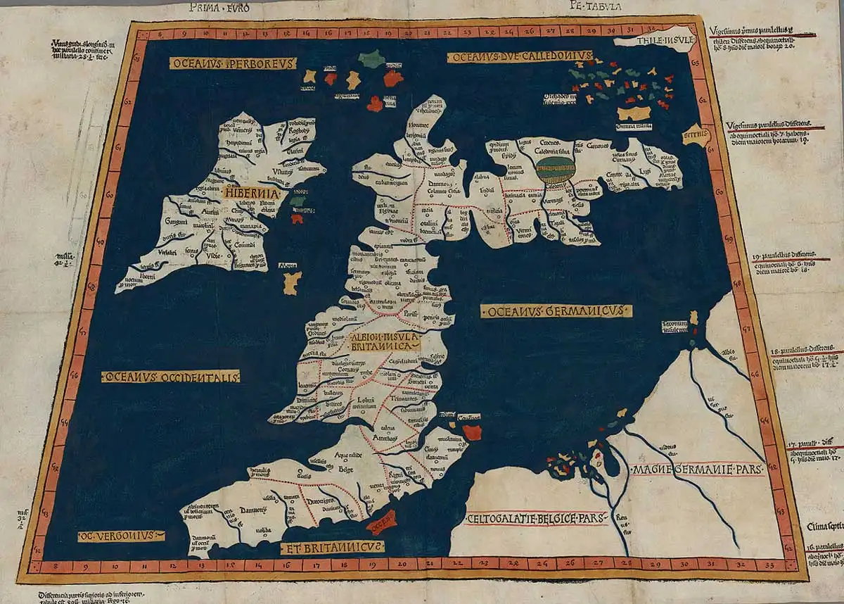
Thule
Vallancey, George
Charles Vallancey (1721-1812) was a military surveyor in the British Army eventually holding the rank of general. He was sent to Ireland where he eventually settled. He was also an antiquarian who took great interest in the history, 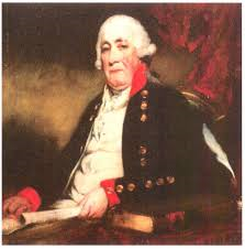 language and mythology of his adopted country. He published a number of books on the subject which have been heavily criticised for both their content and style. He voiced the opinion that the Phoenician and Irish languages were related(a)>and that “the Phoenicians had colonised Ireland in archaic prehistory: When their explorers had searched for Thule, Vallancey affirmed, they had come to Ireland; the word Thule was identical to the Irish word thua, which meant simply ‘north’!”(b)<
Although Valancey made little reference to Atlantis, James McCulloh noted [1588] that Vallancey was disposed to support John Whitehurst’s association of the Giant’s Causeway (See: W.C. Beaumont), in Northern Ireland, with ‘lost Atalantis‘.
(a) https://phoenicia.org/Phoenician-Celtic-connections.html
Iceland *
Iceland has occasionally entered the Atlantis debates. Jean Silvain Bailly and more recently Gilbert Pillot 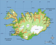 have identified Iceland with Ogygia. Some have linked the island with Thule or Hyperborea, while others see it as a remnant of a transatlantic landbridge. Harry Dale Huffman has similar ideas but believes that the landbridge also held Atlantis.
A recent commentator, Johan Nygren, also considered Iceland, when occupied by Cro-Magnon Man, to have been home of Atlantis(a)(b). This he followed with another paper drawing attention to the similarities between a map of Greenland and the famous 17th-century map of Atlantis published by Athanasius Kircher. More confusion was caused by an earlier document(c) in which he decided that South America was Atlantis and has since had it removed from the internet!
Another recent advocate for an Icelandic location is June Austin in a lengthy blog, which wanders all over the place, including the claim that a disproportionately large number of Icelandic people have psychic abilities(d). Sadly, she offers nothing but speculation to support her theory.
(a) https://steemit.com/atlantis/@johan-nygren/iceland-as-atlantis-2-0
(c) Having discovered the myth of Atlantis in the past days, I’ve now conformed to that it described South America (“Isla Atlantica”) — SteemKR (archive.org) (link now broken!)
Pytheas
Pytheas was a 3rd century BC navigator from the Greek colony of Massalia (Marseilles) and is best known for his voyage in the North Atlantic, possibly around 240 BC. His trip took in the British Isles and as he ventured further North and claimed to have reached Thule.
>Gregory Douglas Wear, in his study of early excursions by Mediterranean peoples into the North Atlantic concluded that with the current state of archaeological and historical research, it is nothing less than impossible to verify with certainty, whether Greeks, Phoenicians, Carthaginians or any other pre-Pythean Mediterranean dweller actually set foot on the British Isles, northern France, or anywhere else in north-western Europe north of Galicia(c).<
Thule has generated volumes of debate regarding its location. Pytheas described Thule as lying six days’ sail to the north of Britain. Iceland, Norway(a) and the Faroes along with the Scottish Shetland and Orkney Islands have all been proposed as Pytheas’ Thule.
Søren Tillisch, a Danish archaeologist, accepts that the identification of the Faeroes as the Thule of Pytheas is reasonable, but he still thinks that the Estonian island of Saaremaa in the Baltic is also a feasible candidate(b).
Rhys Carpenter devoted an interesting chapter of his Beyond the Pillars of Hercules[221] in which he suggested that Pytheas’ voyage was undertaken with commercial objectives in mind, but on that level it was unsuccessful. However, as a voyage of discovery, it was an unparalleled achievement, earning for Pytheas Carpenter’s accolade of ”antiquity’s Greatest Explorer”.
Carpenter favours the idea that the term, ‘Pillars of Hercules’, when applied to the Strait of Gibraltar was used with the sense of boundary markers, indicating ”the limits of the Inner Sea that, for the Greeks, was the navigable world.”[p156]
(a) (99+) (PDF) Pytheas of Massalia’s Route of Travel | Cameron McPhail – Academia.edu
(b) (99+) (DOC) Pytheas of Massalia and the Baltic lecturewpictures | Søren Tillisch – Academia.edu
Goti, Marco
Marco Goti is the Italian author of The Island of Plato[1430] in which he attempts to demonstrate 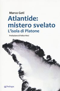 that Atlantis was situated in Greenland. I say attempts because, in my opinion, he fails dismally. He starts by locating the Pillars of Heracles in the Atlantic, with one side being the basaltic columns at the Giants Causeway in Northern Ireland and their counterparts across the sea in Scotland’s Isle of Staffa. This idea was touted by W. C. Beaumont over sixty years earlier(a).
The Cyclopean Islands off the east coast of Sicily near Mt. Etna referred to by Homer in his Odyssey are also known for their basaltic columns.>>At Gunung Padang and Nan Madol there are also numerous columns with comparable volcanic origins.<<
Goti then moves on to Iceland, which he identifies as Thule and spends too much time describing a variety of unpronounceable locations there. He eventually heads for Greenland, which he contends must be Atlantis as it is greater than Libya and Asia combined, ignoring that Plato was referring to might rather than size. Goti posits the huge plain described by Plato to have been situated in the centre of Greenland, ignoring the fact that ice cores dated to over 100,000 years have been identified there, and apart from which the huge island is not submerged. He offers two papers with extracts from his book(b)(c) as well as some evidence of neolithic activity in Greenland(d).
Felice Vinci, who clearly offered some inspiration to Goti, wrote the Foreword to the book and also provided Goti with an archaic Athens in Sweden!
Goti decries other promoters of Atlantis theories for ignoring details in Plato’s account that don’t fit their particular ideas and then he moves Athens to Sweden, has Atlantis above water for hundreds of thousands of years, no elephants, no two annual crops and does not explain how Greenland Atlanteans controlled southern Italy as far as Tyrrhenia, all of which demands a thumbs down from me.
(a) https://www.theflatearthsociety.org/library/pamphlets/Is%20Britain%20the%20Lost%20Atlantis.pdf
(b) The Geometry of Atlantis according to Plato (1/2) – The Tapestry of Time (larazzodeltempo.it)
(c) The Geometry of Atlantis according to Plato (2/2) – The Tapestry of Time (larazzodeltempo.it)
Russo, Lucio
Lucio Russo (1944- ) is an Italian mathematician, physicist and science historian. In his 2013 offering L’ America dimenticata[1060] (The Forgotten America) he bravely suggests that America was discovered by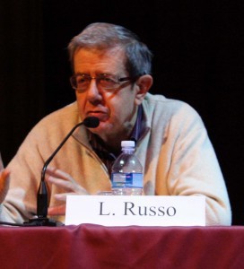 * the Phoenicians or the Carthaginians. He also claims that the longitude of the Lesser Antillies (known as the Isles of the Blest) was known precisely to Hipparchus (190-120BC), but that Ptolemy (90-168AD) later identified the Isles of the Blest with the Canaries and made a catastrophic error when he reduced the circumference of the Earth to 180,000 stadia from the nearly exact figure of 252,000 stadia calculated by Eratosthenes centuries earlier.
Having unravelled Ptolemy’s error Russo was then able to locate the position of Thule on the coast of Greenland(a). Jason Colavito had a few critical words to offer regarding Russo’s theory(b).
>Nevertheless, in an interview, Russo defends the central thesis of his L’ America dimenticata regarding early transatlantic travel. In the link below(c) which offers an English translation of the interview, a number of excerpts from his book are also added.<
(a) https://en.wikipedia.org/wiki/Lucio_Russo
(b) https://www.jasoncolavito.com/blog/italian-mathematician-ancient-greeks-discovered-America
Teleguin, Sergey *
Sergey Teleguin is a Russian professor of Philology and a leading advocate of the idea that the city of Tripura (Triple City) in Vedic tradition was the original inspiration behind Plato’s city of Atlantis. In support  of his contention he has outlined a number of parallels between Plato’s account and the sacred texts of India, the Puranas and Mahabharata, in an extensive English excerpt(a) from his 2005 Russian book, Anatomy of a Myth[1122].
A further claim by Teleguin is that the Popol Vuh, the sacred book of the Maya gives clears evidence that they came from the far north – Ultima Thule. He goes further and attributes a North Pole origin to both the Maya and the Indo-Europeans(b).
He has recently outlined his ideas further in an article for (Nov/Dec 2013) Issue 102 of Atlantis Rising magazine.
He recently reiterated, in an email, his view that Plato’s Atlantis story should only be accepted literally or not at all. It is difficult to accept that an academic could write such nonsense. He cannot be unaware that Plato’s narrative is composed of mythology, history and within the bounds of literary licence, some embellishment of his own. Otherwise, according to Teleguin, we are expected to believe that Clieto actually gave birth to five sets of male twins, that Athens fought a war before it existed and that Poseidon and Atlas were real people! The same absence of critical thinking allows people to believe that the world was created in seven days.
(a) Sergey Teleguin: Atlantis — Vedic Tripura | * ????????? / ATLANTIDA * (primordial.org.ua) *
(b) A NEW STUDY AS TO WHERE THE MAYANS CAME FROM (archive.org) *
Gosselin, François-Pascal-Joseph (L)
François-Pascal-Joseph Gosselin (1751-1830) was a French librarian and geographer. In 1813 he published  the four-volume Recherches sur la géographie systématique et positive des anciens pour servir de base à l’histoire de la géographie ancienne, in which he expressed the view that Thule was another name for Mainland the largest of Scotland’s Shetland Islands. Volumes One(a) and Three(b) are available online.
With regard to Atlantis he considered either Fuerteventura or Lanzarote in the Canaries to have been its location.
(a) https://archive.org/details/bub_gb_ILux6_pz_4kC
Thule
Thule is the name given in ancient Greek and Roman literature for the most northerly part of the world. Around 300 BC the Greek navigator Pytheas claimed to have visited Thule, six days of travel beyond Northern Britain. This may have been Iceland and in support of this idea, a paper was submitted to the 2008 Atlantis Conference in Athens by two Italian researchers, G. Giancarlo and M. Stucchi. In Germanic and Scandinavian traditions the name is applied to a long-lost continent in the North Atlantic.
The Thule-in-Iceland theory has the support of the renowned Professor of European Archaeology, Barry Cunliffe, author of The Extraordinary Voyage of Pytheas the Greek [2081].
The archaeologist, Rhys Carpenter, in a study of Pytheas‘ travels in the North Sea, concluded that the Shetland Islands should be identified as Thule shown on Ptolemy’s map just north of the Orkneys, He argues that “it is an unchallengeable inference that Ptolemy’s data for the location of Thule must go back to Pytheas since no one else in late antiquity ever claimed to have visited that remote region.” [221.183]
Another candidate is the Estonian island of Saaremaa(d), which is also home to the Kaali meteor craters. This meteorite “was a coarse octahedrite, with surviving fragments being only a few grams in weight. Despite the intensity of investigation both inside the craters and outside in nearby peat bogs, the actual date of the impact has been estimated at four widely spaced times: 6400 BC based on microspherules in peat (Raukas 2000); 5000 BC on similar evidence (Tiirmaa and Czegka 1996); 1740–1620 BC based on bulk sediment samples from the near the bottom of the crater lake, or a similar 1690–1510 BC date based on associated terrestrial macrofossils from the deepest part of the lake (Veskiet al. 2004); and 800–400 BC based on peat associated with impact ejecta and iridium in nearby bogs (Veski et al. 2004). Veski and his colleagues argue for the calibrated date range of around 800–400 BC, speculating that the microspherules possibly relate to a separate earlier impact event.”
Felice Vinci is a co-author (with Syusy Blady & Karl Kello) of Il meteorite iperboreo [1906]. in which the Kaali meteor is discussed along with its possible association with the ancient story of Phaeton.
In 2013 Lucio Russo located Thule on the coast of Greenland, having identified errors in Ptolemy’s geographical calculations[1060].
Marin, Minella & Schievenin in The Three Ages of Atlantis [972.375] propose that the island of Thule described by Pytheas was the legendary Hi-Brasil, which in turn they claim was part of the Porcupine Bank that they argue was only ‘recently submerged’.
A 2014 paper(b) by Cameron McPhail addressed the problem of Thule’s location. He “offers a new approach, using information supplied in the fragments of Eratosthenes’ Geography, supports assertions that Pytheas exited the Mediterranean sailing via the Strait of Gibraltar, and that Thule, the most distant locale reached, should be identified with Norway.” and concluded that “The problems of Pytheas’ route of travel cannot all be solved. The two discussed here, on account of the scant primary source information, will remain open to interpretation.“
>Support for a Norwegian Thule received a recent boost when two German investigators from the Technical University of Berlin proposed that the island of Smøla was the Thule of Pytheas. In September 2020, Smithsonian Magazine reprinted an article by F. Salazar from Hakai Magazine(f) outlining this new theory(e).<
A recent article(c) on the National Geographic website noted that “Today, historians aren’t sure if Pytheas’s remote land was based on a real location or whether it is simply a stand-in for any place. Whatever the case, it shows up in the phrase “Ultima Thule”—any extremely remote place on Earth. And the name Thule lives on in Greenland with the Thule Air Force Base; in the Sandwich Islands, one of which is South Thule; and in the name of the 69th element, thulium, discovered by a Swedish chemist.”
(b) (99+) (PDF) Pytheas of Massalia’s Route of Travel | Cameron McPhail – Academia.edu
(d) https://en.wikipedia.org/wiki/Thule
(e) (Smithsonian Sept 8, 2020) This Norwegian Island Claims to Be the Fabled Land of Thule | Travel | Smithsonian Magazine
(f) Hakai Magazine
Hi-Brasil or Hy-Brasil
Hi–Brasil or Hy–Brasil is sometimes referred to as the Irish Atlantis and is a name given to a legendary island to the west of Ireland. It is frequently referred to as the Fortunate Island, which has obvious resonances with the Hesperides. Another appellation in Irish is Tir fo-Thuin or Land under the Wave. A further explanation offered for the origin of the name is that it is derived from an ancient term ‘brazil’ that refers to the source of a rare dye, which is reminiscent of the expensive purple dye extracted from the Murex snail, traded by the Phoenicians.
One theory is that in the dim and distant past a part of what is now known as the Porcupine Bank, just west of Ireland, was exposed when the sea levels were lower as a result of the last Ice Age. When the feature was submerged by the rising seas it was probably eroded further by the ocean currents. The claim is that a memory of the exposed land lingered in the folk memory of the inhabitants of the west coast of Ireland.
Marin, Minella & Schievenin in The Three Ages of Atlantis [972.375] propose that the island of Thule described by Pytheas was the legendary Hi-Brasil, which, they further claim, was part of the Porcupine Bank that they describe as ‘recently submerged’.
The Genoese cartographer, Angellino de Dalorto (fl.1339), placed Hy-Brasil west of Ireland on a map as early as 1325. However, on some 15th-century maps, the islands of the Azores appear as Isola de Brazil, or Insulla de Brazil. Apparently, it was not until as late as 1865 that Hy-Brasil was finally removed from official naval charts. Also found on medieval maps was another mystery island south of Brasil, sometimes appearing as Mayda, Asmaidas or Brazir(d).
Phantom islands have been shown on maps for hundreds of years and some as recently as the 20th century(f).
One of the most famous visits to Hy-Brasil was in 1674 by Captain John Nisbet of Killybegs, Co. Donegal, Ireland. He and his crew were in familiar waters west of Ireland, when a fog came up. As the fog lifted, the ship was dangerously close to rocks. While getting their bearings, the ship anchored in three fathoms of water, and four crew members rowed ashore to visit Hy-Brasil. They spent a day on the island and returned with silver and gold were given to them by an old man who lived there. Upon the return of the crew to Ireland, a second ship set out under the command of Alexander Johnson. They, too, found the hospitable island of Hy-Brasil and returned to Ireland to confirm the tales of Captain Nisbet and crew.
The last documented sighting of Hy-Brasil was in 1872 when author T. J. Westropp and several companions saw the island appear and then vanish. This was Westropp’s third view of Hy-Brasil, but on this voyage, he had brought his mother and some friends to verify its existence.
The Irish historian, W.G.Wood-Martin, also wrote[388.1.212] about Hi-Brazil over a hundred years ago.
Donald S. Johnson has also written an illustrated and more extensive account of the ‘history’ of Hi-Brazil in chapter six of his Phantom Islands of the Atlantic [652].
A modern twist on the story arose in connection with the Rendelsham UFO(b) mystery/hoax(c) of 1980 when coordinates that correspond to one of the Hy-Brasil locations were allegedly conveyed to one Sgt. Jim Penniston who kept it secret for thirty years(a)!
In 2010, the September 11th edition of the London Daily Mail (and its sister paper, the Irish Daily Mail) ran an article with the adventurous headline “The Atlantis of Connemara” that included the accounts of 20th-century witnesses to unexplained visions off the west coast of Galway. Included was a potted history of recorded sightings since 1460.
In 2013 Barbara Freitag published a valuable in-depth study[1331] of Hy-Brasil dealing with its cartography, history and mythology.
(b) The Rendlesham Forest UFO case – Ian Ridpath (archive.org)
(c) (BBC June 30, 2003) https://www.bbc.co.uk/insideout/east/series3/rendlesham_ufos.shtml
(d) https://en.wikipedia.org/wiki/Mayda
(e) http://web.archive.org/web/20220118093816/https://atlantipedia.ie/samples/archive-2272/
(f) https://en.protothema.gr/a-list-of-various-phantom-islands-recorded-throughout-history/
Arctic Region
The Arctic Region offers evidence of human activity as long as 45,000 years ago, 10,000 years earlier than previously thought, according to a report(f) in 2016.
Of interest to us is that Spitzbergen was proposed as the location of Atlantis by the French astronomer Jean Silvain Bailly in the 18th century. In 1885, Dr. 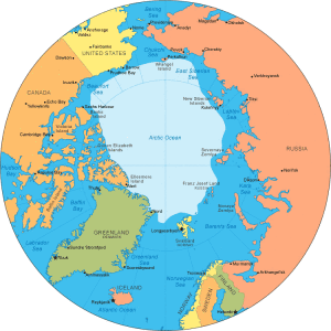 W. F. Warren,a former president of Boston University, published a book[078]that proposed that the cradle of the human race was situated at the North Pole and had been inundated at the time of the Deluge. Warren’s book can now be accessed online(d), while a brief, but caustic, review of his theory was undertaken by Jason Colavito a few years ago(i).
Bal Gangadar Tilak, an Indian independence campaigner, was so impressed by Warren’s ideas that in his book, Arctic Home in the Vedas [1296], he chose to locate the lost Paradise of Airyana Vaejo in the Arctic(e). The British philosopher, J.G. Bennett was sympathetic to Tilak’s ideas and proposed their further investigation, while being more dismissive of Warren’s reasoning(j).
More recently, Gene Matlock also claimed that the Garden of Eden had been situated at the North Pole(h).
Modern Russian nationalism seems to have adopted some of the dafter notions of Nazi Germany, including the idea of an Aryan master race, from which they claim to be descended, that was formerly located in the Arctic. It was revealed in 2016 that a former Nazi base had been discovered in the Arctic, which had been used to search for ancient artefacts(g).
Such ideas are expounded by the new darling of Russian neo-fascism, Alexander Dugin, who likes to blend nationalism with mysticism. It is rather worrying that some elements of this nationalism have also adopted anti-semitism as part of their rhetoric(b).
More recently, Professor Sergey Teleguin has again drawn attention to Tilak’s work in an article that identifies elements in the Mayan Popul Vuh, which suggest that its origins were in the far north, in Ultima Thule. He concludes with the thought that perhaps the Indo-European and Mayan ancestors came from the true North Pole! Teleguin has outlined his ideas further in an article for (Nov/Dec 2013) Issue 102 of Atlantis Rising magazine.
In 1906, the American explorer, Robert Peary, made a failed attempt to be the first to reach the North Pole. On his return, he claimed that he had seen a previously unknown, massive landmass complete with soaring mountains and deep valleys, which he called Crocker Land after one of his sponsors. His story received a mixed reception, but another well-known explorer, Donald Baxter MacMillan, took Peary’s account at face value and organised an expedition to find Crocker Land, which set out in July 1913. Where Peary’s attempt was a failure, MacMillan’s was a disaster that ended in murder. Needless to say, Crocker Land was not found, as it does not exist in the Arctic any more than Atlantis does. The story is a fascinating read(k).
(b) Archive 2415)
(d) https://www.sacred-texts.com/earth/pf/index.htm
(e) https://archive.org/details/in.gov.ignca.9566/page/n7/mode/2up
(f) https://www.sciencemag.org/news/2016/01/grisly-find-suggests-humans-inhabited-arctic-45000-years-ago
(h) http://www.viewzone.com/edenpole.html
(i) http://www.jasoncolavito.com/blog/was-the-garden-of-eden-at-the-north-pole
(k) The Quest for the Mysterious Lost Atlantis of the Far North | Mysterious Universe *

