Latest News

Joining The Dots
I have now published my new book, Joining The Dots, which offers a fresh look at the Atlantis mystery. I have addressed the critical questions of when, where and who, using Plato’s own words, tempered with some critical thinking and a modicum of common sense.Read More »
James Bramwell
Cadet, Jean-Marcel
Jean-Marcel Cadet (1751-1835) was French mineralogist, who was Inspector of Mines on Corsica for 25 years. He wrote a number of papers and books on the geology of the island. Included in his output was Memoire sur les jaspes et autres pierres precieuses de l’isle de Corse(a), published in 1785, in which he also reviewed Plato’s account of Atlantis in his Critias and Timaeus and concluded that Atlantis had been situated in the Atlantic.
James Bramwell[0184.137] claims that Cadet was the first to express the view that Atlantis had been an island in the Atlantic and that the Canaries and the Azores were its remnants.
My previous entry under the name of Louis Claude Cadet de Gassicourt was completely incorrect, for which I apologise.
Atlantomaniac (m)
Atlantomaniac is the rather colourful term used to describe Atlantis believers who are ‘over-enthusiastic’ in their support for their pet theory. The earliest use that I can find is by James Bramwell in 1937 in his Lost Atlantis[195], who was describing the activities of a group who broke up a meeting in 1927 in Paris’ Sorbonne with ‘tear-gas’ as they objected to the views regarding Atlantis being expressed there(a).
*[Zhirov noted[0458.17] “that the interference of the atlantomaniacs has greatly harmed science, for it discredited the Atlantis problem in the eyes of many scientists.” Although he wrote this nearly half a century ago, it still holds true.]*
Speculum Regale, The (L)
The Speculum Regale (The King’s Mirror)(a) was written in Norway around 1250 AD. Bramwell notes that in it, Ireland was identified with Atlantis[195.181].
Bramwell was mistaken, referring to a land-under-the-waves (Tir fo thuinn) which is a term sometimes applied to Hy-Brasil a mythical sunken land to the west of Ireland.
(a) https://www.archive.org/stream/kingsmirrorspecu00konuuoft/kingsmirrorspecu00konuuoft_djvu.txt
Shewan, Alexander
Alexander Shewan (1851- 1941) had worked for the Indian Civil Service, but was better known as an Homeric scholar.
James Bramwell noted[195.88] that Shewan accepted that the Atlantis story had been familiar to the Egyptians, but that it had been embellished with details from Crete.
Leslie Shepard, in his Introduction to a 1968 edition of Lewis Spence’s The Histoy of Atlantis, notes that it used be fashionable to jeer at the existence of Atlantis but, as the Homeric scholar, Professor Alexander Shewan points out, “that can hardly continue, now that Mr. Lewis Spence has examined the evidence at length in The Problem of Atlantis, Atlantis in America, and The History of Atlantis.”
Schoinos
Schoinos, which means ‘rope’ in Egyptian was an ancient unit of measurement the equivalent of 40 stadia, but had huge regional variations ranging from 30 to 120 stadia(a). It was widely used throughout the Mediterranean and was adopted by the Greeks from the Egyptians around 2000 BC(d).
Albert Herrmann, quoted by Bramwell [195.117], attempted to make sense of the dimensions of the ditch surrounding the Plain of Atlantis, by suggesting that Solon had been misled by an interpreter who converted the Egyptian measurements into Greek ‘podes’ (feet) but erroneously gave the results as ‘stadia’, exaggerating the data by a factor of thirty!
However, for me, Herrmann’s highly speculative theory makes little sense. If the ‘schoinos’ was used by the Greeks since 2oooBC, why convert it at all? Herodotus refers to it at least twice in his Histories (2.6(b) and 2.149(c))
(a) https://en.wikipedia.org/wiki/Schoenus
(b) https://www.sacred-texts.com/cla/hh/hh2000.htm
Rivaud, Albert
Albert Rivaud (1876-1955) was a French professor of philosophy and a classical scholar. Ivar Lissner, commenting[725.158] on the unfinished nature of the trilogy of Plato’s Dialogues, which included Timaeus and the incomplete Critias, quotes Rivaud as saying that what we have contains “not only ancient traditions but also the results of the latest contemporary research carried out during Plato’s lifetime.”
Rivaud published a translation of the complete works of Plato in the early 1920’s. Volume 10 was Platon. Oeuvres complètes, Tome X.: Timèe, Critias. In it, according to James Bramwell[0195.91], he demonstrated that the term ‘orichalcum’ was known before Plato and not just an invention of his.
Later in his life Rivaud blotted his copybook with expressions of anti-Semitism and admiration for Hitler.
Strabo
Strabo (c. 64 BC – 23 AD) was an important Greek geographer and historian 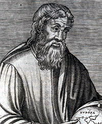 who wrote (a) of his full agreement with Plato’s assertion that Atlantis was fact rather than fiction. An English translation of his Geography (Geographica) in three volumes can be read online [1647].
The location of the Pillars of Heracles, mentioned by Plato, is assumed by many to have always been situated near the Strait of Gibraltar. Other researchers have claimed that this was not the only location and have referred to various classical writers to support this contention, one of whom was Strabo, who records(b) the variety of opinions regarding the location of the Pillars of Heracles among classical writers, adding that Alexander the Great on reaching the easternmost point in his military campaign erected an altar with ‘Pillars of Heracles’, giving further support to the view that the ‘Pillars’ were not a singular landmark but a feature that was to be found at different locations at different points in history. Strabo produced a map of Europe on which he located the ‘Pillars’ at Gibraltar in his day (1st century AD). Strabo also noted that, in the distant past 300 cities lined the coasts on either side of the Pillars.
Strabo also wrote (c) of Hera’s Island as being one of two islands located near the Pillars of Heracles, beyond which was Gades in Spain. The two islands have not been identified. He was writing some centuries after Erathostenes had placed the ‘Pillars’ at the western end of the Mediterranean.
James Bramwell has cast some doubt on the reliability of ancient geographers in general and Strabo in particular, whom he claims[195.129] oriented the Pyrenees as running north-south rather than their actual east-west. Nevertheless, Strabo’s reputation would appear to have been enhanced by the discovery a few years ago that Piraeus, a small peninsula near Athens had been an island around 6,000 years earlier. Over time, sedimentary deposits had gradually built into an isthmus joining the island to the mainland. Strabo had recorded the earlier island status of Piraeus two thousand years ago, millennia after the event and unconfirmed until now(d).
I should mention that, coincidentally, a temple of Hera was discovered near Marsaxlokk on Malta, the larger of the two principal Maltese islands.
(a) Geographia (2.3.6/7)
(b) Geographia (3.5.5)
(c) Geographia (3.5.3)
(d) Ancient Greek Knew Geology Thousands of Years Before His Time | Discover Magazine (archive.org)
Stade *
The Stade was an ancient Greek measurement of distance. The origins of the stade are not clear. One opinion claims that at first, it was the distance covered by a plough before turning. Later it was the length of a foot race in a Greek Stadion (Roman Stadium) or 157 meters. Different ‘standard’ stadia existed in various city-states of ancient Greece ranging from 157 to 211 meters.
Some commentators have treated the stade as a synonym for the British ‘furlong’ (one eight a mile or 220 yards – approximately 201 metres), which was an old Anglo-Saxon measure for a ‘long furrow’.
Nick Kollerstrom has published a paper on Graham Hancock’s website arguing that “Mother Earth was clearly the source of the Greek stade, though the ancient Greek philosophers do not seem to have been aware of this fact.”(e)
Most commentators on Plato’s Atlantis seem to accept a value of 185 metres (607 feet) to the stade. Thorwald C.Franke argues for a value of 176 metres – ” It is confusing: The building called “stadion” had been 185 meters, but the measure “stadion” not. We can conclude that the Athenians once had a shorter building, but decided to build a bigger building in later times. It is the same story for the “stadion” of other cities.” (private correspondence)
The problem that has arisen is that irrespective of whichever stade was used by Plato, the resulting dimensions suggested by him are unacceptably large. This has led quite a number of commentators to suggest that Plato’s use of the stade was possibly due to some misunderstanding or transcription error and have striven to find a more credible unit of measurement.
Jim Allen who is the leading advocate for a Bolivian location for Atlantis has used a value for the stade that is half the conventionally accepted 185 metres. He bases this on the fact that the ancient South Americans used a base of 20 rather than 10 for counting. He offers an interesting article with impressive images on his website(a) in support of his contention.
Dr Rainer Kühne, who recently publicised that a site in Andalusia, identified by Werner Wickboldt from satellite photos, suggested that Plato used a stade that was probably 20% longer than what is normally accepted since the dimensions of the Spanish site are greater than those given in Plato’s text. This idea is not satisfactory as so many other dimensions of the city’s features already suggest over-engineering on a colossal scale. To add a further 20% would be even more ridiculous.
If the dimensions of Atlantis did originate on the pillars in the temple at Sais, the unit of measurement used was probably Egyptian (or Atlantean) and so their exact value must be open to question. The values given by Plato relating to Atlantis have long been ammunition for sceptics. They argue that Plato’s topographical data suggests either a degree of over-engineering that was improbable in the Bronze Age or impossible in the Stone Age and must, therefore, be a fantasy.
In the 1930s and 1940s, there was a degree of confusion among those reluctant to accept that the Greek ‘stade’ was a reliable unit of measurement for the architectural features described by Plato in Atlantis. Alexander Braghine in 1940, seems to have the matter entirely confused when he wrote [156.58] about Albert Hermann‘s proposal of 1934 that the unit of measurement used by the Egyptians to describe Atlantis was the ‘shoinos’, which Braghine noted is 604 times shorter than a stade, which is completely wrong or just a misprint that should read 60! Earlier in 1937 James Bramwell also commented on Hermann’s suggestion that it was the Egyptian ‘schoinos’, which is equivalent to 30 stadia [195.117].
William Smith’s Dictionary of Greek and Roman Antiquities, noted that “SCHOENUS (?, ?, ???????), literally, a rope of rushes, an Egyptian and Persian itinerary and land measure (Herod. i. 66). Its length is stated by Herodotus (ii. 6, 9) at 60 stadia, or 2 parasangs; by Eratosthenes at 40 stadia, and by others at 112 or 30. (Plin. H. N. v. 9. s. 10, xii. 14. s. 30.) Strabo and Pliny both state that the schoenus varied in different parts of Egypt and Persia. (Strabo, p. 803; Plin. H. N. vi. 26. s 30; comp Athen. iii. p. 122, a.) [–Phillip Smith]”
An award-winning paper by Newly Walkup discusses in detail Eratosthenes attempt to measure the circumference of the Earth(f).
Today, Wikipedia proposes a conversion rate of 40 schoeni to the stade(c).
The late Ulf Richter proposed a simple solution to this problem(b), namely that the unit of measurement originally recorded was the Egyptian Khet. This was equivalent to 52.4 metres or approximately 3.5 times less than the value of the stade. The acceptance of this rational explanation removes one of the great objections to the veracity of the Atlantis narrative.
The most recent entrant into this particular debate is M.P. Courville [1960.10] who has proposed that Plato intended to use the plethrum, which is around 30 metres long or very roughly one-fifth the length of a stade. The problem arising from that idea is that Plato also uses the plethrum together with the stade in contexts where they both seem too large (Crit.116a & 118c)!
Jean-Pierre Pätznick commented in a paper on the Academia.edu website that “the 10,000-stadia ditch that would have surrounded the great plain on three sides would in fact have measured 1850 km long, 30.80 m deep and 185 m wide. A colossal structure that would have been 23 times larger than the Panama Canal and nearly 10 times larger than that of the Suez Canal!”(d)
It seems that all of Plato’s numbers, or at least all the larger ones, appear to be exaggerations and in my opinion, should be reduced by a common factor to bring them in line with credibility. I have elaborated more fully on this in Joining the Dots.
(a) https://web.archive.org/web/20200709181313/http://www.atlantisbolivia.org/atlantisstade.htm
(b) https://web.archive.org/web/20180728113519/http://www.atlantisbolivia.org/ulfrichterstade.htm
(d) Jean-Pierre Pätznick and the Egyptian Atlantis (atlantis-scout.de) *
(e) Ancient Units and Earth-Measure – Graham Hancock Official Website
Sea-Level Changes
Sea-Level Changes. Recent years have seen the production of ever more detailed data relating to sea-level changes following the last Ice Age. In 2006, researchers discovered that the Bering Strait between Siberia and Alaska was created around 9000 BC, a thousand years earlier than previously thought.
Such changes could have had a direct bearing on the Atlantis mystery, particularly if Plato’s assertion that its inundation took place in 9600 BC is true, as this would place the event at the end of the last Ice Age and the melting of the glaciers, with the consequent raising of the level of the oceans. Although we are usually given the impression that this deglaciation progressed steadily, it would appear that in reality the process continued at different rates and was at times temporarily reversed.
Recent studies(f) have clearly indicated that Aboriginal Australians have preserved memories of the rising sea level at the end of the last Ice Age.
A 2000 report(c) from Dr Robert Baker and Professor Peter G.Flood from the University of New England in New South Wales, suggests that 4,000 years ago sea levels “may have been up to two metres higher than at present and that sea levels have risen and fallen like a roller coaster over the last 6,000 years.” I would expect that sea levels two metres higher around 2000 BC would have left archaeological evidence on a global scale. Until that is forthcoming, I would treat this claim with caution.
Dr Robert Haworth, who worked with Dr Baker, endorsed the conclusions of Baker and Flood(k). A few years later Haworth found further evidence of higher temperatures and sea levels in the Sydney area 6,000 years ago(l).
 Estimates of the total change in sea levels vary between 300 and 500 ft. The most recent studies have estimated the rate of sea-level rise at an average of one metre per century, punctuated by occasionally increased rates of 2.5 metres per century(a). To complicate the picture further, many areas in northern latitudes that had been depressed by the weight of the enormous ice sheets of the last Ice Age, rose considerably as a result of isostatic rebound when the glaciers melted. This process continues in some regions, albeit at a slower rate.
There is general agreement that the raising of the sea-levels had dramatic consequences worldwide. Vast landmasses, such as Sundaland, the Celtic Shelf, and the Caribbean, were totally or partially submerged, leaving many of today’s islands as remnants. Communities that had flourished in these regions during the last Ice Age must have been devastated which naturally led to the generation of myths recalling their former glory. Atlantis is assumed to be one such legend with a firm basis in reality.
Other, more controversial effects have also been proposed, such as the breaching of a landbridge that had existed between Spain and North Africa at Gibraltar and/or a similar isthmus between Sicily and Tunisia. James Bramwell reports that in the 1930s geologists spoke freely of the breaching of a Gibraltar dam around 15,000 years ago. More recently, writers such as Joseph S. Ellul, Sergio Frau and Paulino Zamarro have convincingly based their Atlantis theories on this concept. The Mediterranean sea level is discussed elsewhere.
Other writers have proposed an asteroidal or cometary impact as the cause of catastrophic flooding, but such inundations would have receded fairly rapidly. In the end, we are left with the ending of the last Ice Age as the primary cause of profound changes in the topography of our planet which probably included the submergence of one civilisation that we now refer to as Atlantis.
However, Plato introduces another detail into his Atlantis narrative, namely that following the submergence of Atlantis, it created a maritime hazard in the form of shoals. Plato wrote that “wherefore also the ocean at that spot has now become impassable and unsearchable, being blocked up by the shoal of mud which the island created as it settled down.” (Timaeus 25d). The implication of this is that the shoals still existed in either Solon’s or Plato’s lifetime. We must also keep in mind that the draft of ships, such as triremes, at that time was about a metre. The attached chart shows how, between 5000 BC and the present, the rate of sea level has been relatively slow. Even allowing for any local seismic, tectonic or isostatic activity, I would interpret the data to suggest two important facts; first, the flooding of Atlantis could not have taken place before 5000 BC and still be a hazard in the first millennium BC and secondly, if it occurred after 5000 BC, Atlantis must be still in shallow water.
Kurt Lambeck has demonstrated from a study of Roman fish pens that the sea level along the Italian coast, 2000 years ago, was 1.35 metres below today’s levels. His investigations also included a study of land elevations along the coast that may have been affected by seismic or tectonic processes and found that they had raised the land by 1.22 metres, indicating that global sea levels had risen by just 13cm over the past two millennia, most of which has occurred over the past century(d)! Lambeck’s conclusions have been severely criticised by Izabol Apulia(e).
Professor Nicholas Flemming of the University of Southampton has written extensively on the subject of sea-level changes [1682], particularly in the Mediterranean(h). A more localised study of sea-level changes around Malta during the Holocene has been produced by an Italian team led by Stefan Furlani(i).
Furthermore, if the destruction took place before 5000 BC, then either Solon or Plato concocted the description of the shoals, which would have no purpose whatsoever!
Sea level changes in the Gulf of Mexico are discussed in an online pdf file(b). In the same region, there is now claimed to be evidence(g) confirming that sea levels were lower during the last Ice Age and that the Yucatan Peninsula was very much larger.
A June 2021 report(j) concluded that Israeli sea levels rose at a relatively fast rate of 2 – 2.5 metres within 200 years between the Hellenistic and Roman periods. I am not aware of any corroboration from other sites in the region, so, lacking any such evidence, I am forced to conclude that this is more likely to have been the consequence of localised seismic activity rather than a more general rise in sea levels. On the other hand, seismic events are usually instant and not spread over centuries! Further investigation is required.
(a) https://www.sciencedaily.com/releases/2010/12/101201120605.htm
(c) https://web.archive.org/web/20110912071448/https://www.abc.net.au/quantum/stories/s112352.htm
(d) https://www.freerepublic.com/focus/news/1192397/posts
(e) http://web.archive.org/web/20191216092056/https://atlantipedia.ie/samples/archive-2566/
(f) https://theconversation.com/ancient-aboriginal-stories-preserve-history-of-a-rise-in-sea-level-36010
(g) https://phys.org/news/2016-11-dino-killing-crater-clues-ice-age.html
(h) https://www.gresham.ac.uk/watch-now/humanity-and-million-years-sea-level-change *
(i) https://www.researchgate.net/publication/235606249_Holocene_sea_level_change_in_Malta
(k) Atlantis Rising magazine # 22 p11
(l) https://www.abc.net.au/science/articles/2004/04/01/1078868.htm?site=tv&topic=latest
Glozel
Glozel is a village about 20km from Vichy in the centre of France. In 1924, a  seventeen-year-old boy, Émile Fradin (1906-2010)(b), discovered many artefacts including inscribed tablets with writing similar to ancient Phoenician scripts. Some of the pottery depicted animals extinct in the area for over 10,000 years. A group of academics was assembled in 1927 to decide on the authenticity of the find. The experts decided that the whole collection was forged. It must be remembered that at the time the Piltdown controversy was at its height, leaving any reputation-conscious scientist very wary.
Nearly fifty years passed until, in 1975, using a new dating method known as thermoluminescence, the antiquity of the Glozel objects was confirmed as ranging from 300 BC to 1300 AD, exonerating the then 68-year-old Émile Fradin from any suggestion of fraud.
Discoveries of similar objects have been found at other nearby sites, for example at Moulin Piat, 2.5km south, at Guerrier, 3 km away on the right bank of the River Vareille (some pieces can be found at the Earth Science Museum of Villeurbanne University); at Puyraval 10 km upstream. In recent times an extensive Neolithic site with a remarkable megalithic alignment composed of over 100 stones was discovered near Glozel.
The Atlantis perspective on this is that Glozel appeared to offer evidence of ancient cultural development, including writing, in this part of Europe, far earlier than previously thought possible. The initial claims were seen as possible support for the 9600 BC date given by Solon for Atlantis.
Claudius Roux is quoted by James Bramwell [195.111] as saying “I wonder then whether the Glozel mystery does not tend to merge into the mystery of Atlantis, and whether the regions round the Pillars of Hercules have not in prehistoric and protohistoric times played an important part in civilization……………..further researches in France, Spain and in North Africa will prove perhaps that this hypothesis is well-founded, at the same time enabling the Atlantean problem to be cleared up.”
However, it does not appear credible to me, that 10,000-year-old inscriptions exist that are similar to Phoenician scripts. The intervening 8,000 years would have altered the shape of the characters out of all recognition, just as our modern Roman script is different to its antecedents in the Eastern Mediterranean just three thousand years ago. The thermoluminescence tests support this view, but the Glozel writing still has value as an example of ancient scripts.
Alice Gerard, a retired archaeologist from New York, has spent the last decade studying the mystery of the Glozel site and has written[334] of her efforts to verify the authenticity of the discoveries there and dispel the initial response of scientists who dismissed it as a hoax. Her book is supported by a website(a).
The excellent Migration and Diffusion website has a paper(c) written by the American Donald B. Buchanan, Secretary of The Epigraphic Society, which offers a preliminary decipherment of the Glozel script. Paulo Stekel has built on Buchanan’s work and offers a couple of papers of his own(d)(e). A (French) site dedicated to Glozel translation attempts is also available(f).
Philip Coppens on the internet(g)(h) and later in The Lost Civilisation Enigma, reviews[1275.16] the early years of the Glozel debate in which his account reflected very badly on the professional archaeologists of the day and later. While the evidence now indicates that no fraud by Fradin was involved, there are still questions outstanding, relating to the mixed dating of the artefacts themselves.
In 2020, Catherine Breniquet published a paper entitled, How Writing Came About in Glozel, France(i) in which she reviews the history of the Glozel artefacts and the script to be found on them, with particular reference to the possibility that they are forgeries.
(a) See: https://web.archive.org/web/20161014200636/https://www.glozel.net/
(b) https://www.telegraph.co.uk/news/obituaries/science-obituaries/7370099/Emile-Fradin.html
(c) http://www.migration-diffusion.info/article.php?subject=linguistics&id=147
(d) Wayback Machine (archive.org)
(e) Wayback Machine (archive.org)
(f) Traducteurs actuels de Glozel (archive.org)
(g) Glozel: the fraud or find of the 20th century? – Eye Of The Psychic
(h) https://web.archive.org/web/2/https://www.eyeofthepsychic.com/glozel_politics/
(i) https://www.researchgate.net/publication/347390439_How_Writing_Came_about_in_Glozel_France